Luxaflex Belgium
Luxaflex Belgium is an industrial building in Bruges, West Flanders, Flanders which is located on Dirk Martensstraat. Luxaflex Belgium is situated nearby to Hamiltonpark, as well as near the playground Speeltuin Peter Benoitlaan.| Tap on a place to explore it |
Places of Interest Nearby
Highlights include Belfry and Groeningemuseum.
Belfry

Photo: Jean-Pol GRANDMONT, CC BY-SA 4.0.
The Belfry of Bruges is a medieval bell tower in the centre of Bruges, Belgium. One of the city's most prominent symbols, the belfry formerly housed a treasury and the municipal archives and served as an observation post for spotting fires and other dangers. Belfry is situated 1½ km east of Luxaflex Belgium.
Groeningemuseum
Museum
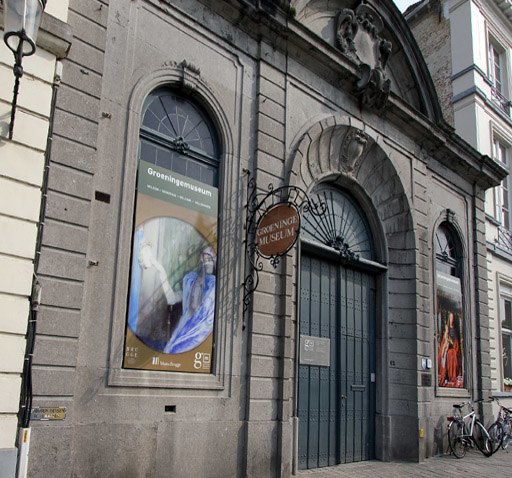
Photo: Le Fou, CC BY-SA 3.0.
The Groeningemuseum is a municipal museum in Bruges, Belgium, built on the site of the medieval Eekhout Abbey. It houses a collection of Flemish and Belgian painting covering six centuries, from Jan van Eyck to Marcel Broodthaers. Groeningemuseum is situated 1½ km east of Luxaflex Belgium.
Church of Our Lady
Church

Photo: Wolfgang Staudt, CC BY 2.0.
The Church of Our Lady is a Roman Catholic church in Bruges, Belgium, dating mainly from the 13th, 14th and 15th centuries. Its 115.6-metre-high tower remains the tallest structure in the city and the third tallest brickwork church tower in the world. Church of Our Lady is situated 1½ km east of Luxaflex Belgium.
Places in the Area
Nearby places include Ezelstraatkwartier and Boeveriewijk.


Sint-Pieters
Village

Photo: MJJR, CC BY-SA 3.0.
Sint-Pieters, sometimes also called Sint-Pieters-op-den-Dijk, is a quarter of Bruges, in the province of West Flanders, Belgium. It was a separate municipality until 1899. In 1899, it was merged into Bruges.
Luxaflex Belgium
- Type: Industrial building
- Address: Dirk Martensstraat 3
- Categories: building and industry
- Location: Bruges, Arrondissement of Bruges, West Flanders, Flanders, Belgium, Benelux, Europe
- View on OpenStreetMap
Latitude
51.20942° or 51° 12′ 34″ northLongitude
3.20196° or 3° 12′ 7″ eastOpen location code
9F356652+QQOpenStreetMap ID
way 731816541OpenStreetMap feature
building=industrial
This page is based on OpenStreetMap, Wikidata, and Wikimedia Commons.
We’d love your help improving our open data sources. Thank you for contributing.
Satellite Map
Discover Luxaflex Belgium from above in high-definition satellite imagery.
Notable Places Nearby
Highlights include Hamiltonpark and Speeltuin Peter Benoitlaan.
Nearby Places
Explore places such as Raytech bvba and Gabriëls Brugge.
West Flanders: Must-Visit Destinations
Delve into Kortrijk, Ostend, Ypres, and Roeselare.
Curious Industrial Buildings to Discover
Uncover intriguing industrial buildings from every corner of the globe.
About Mapcarta. Data © OpenStreetMap contributors and available under the Open Database License". Text is available under the CC BY-SA 4.0 license, except for photos, directions, and the map. Photo: MJJR, CC BY 3.0.