Dockland Settlements Community Centre
Dockland Settlements Community Centre is a building in London Borough of Southwark, Greater London, England which is located on Salter Road. Dockland Settlements Community Centre is situated nearby to cows, as well as near donkeys.| Tap on a place to explore it |
Places of Interest Nearby
Highlights include Surrey Docks Farm and Holy Trinity Church.
Surrey Docks Farm

Photo: Steven Walling, CC BY-SA 3.0.
Surrey Docks Farm is a working city farm in the heart of London. It occupies a 2.2-acre site on the south bank of the River Thames in Rotherhithe. Surrey Docks Farm is situated 440 feet northeast of Dockland Settlements Community Centre.
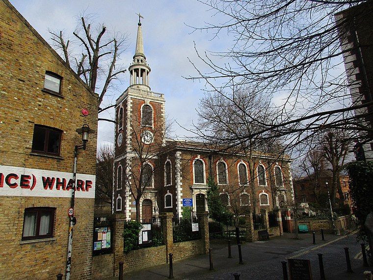
Holy Trinity Church
Church

Photo: John Salmon, CC BY-SA 2.0.
Holy Trinity Church is a Church of England parish church in Rotherhithe, south east London, within the diocese of Southwark. Holy Trinity Church is situated 480 feet north of Dockland Settlements Community Centre.
Rotherhithe (Holy Trinity) War Memorial
Memorial

Photo: Stephen Craven, CC BY-SA 2.0.
Rotherhithe (Holy Trinity) War Memorial is situated 410 feet north of Dockland Settlements Community Centre.
Places in the Area
Nearby places include Rotherhithe and Cuckold’s Point.
Rotherhithe
Suburb
 Rotherhithe is a district of South London, England, and part of the London Borough of Southwark. It is on a peninsula on the south bank of the Thames, facing Wapping, Shadwell and Limehouse on the north bank, with the Isle of Dogs to the east.
Cuckold’s Point
Locality
Cuckold's Point, also Cuckold's Haven, is part of a sharp bend on the River Thames on the Rotherhithe peninsula, south-east London, opposite the West India Docks and to the north of Columbia Wharf.
Surrey Quays
Quarter

Photo: Secretlondon, Public domain.
Surrey Quays is a largely residential area of Rotherhithe in south-east London, occupied until 1970 by the Surrey Commercial Docks. The precise boundaries of the area are somewhat amorphous, but it is generally considered to comprise the southern half of the Rotherhithe peninsula from Canada Water to South Dock; electorally, Surrey Docks is the eastern half of the peninsula.
Dockland Settlements Community Centre
- Type: Building
- Address: 400 Salter Road, London, SE16 5AA
- Location: London Borough of Southwark, Greater London, England, United Kingdom, Britain and Ireland, Europe
- View on OpenStreetMap
Latitude
51.49919° or 51° 29′ 57″ northLongitude
-0.03514° or 0° 2′ 7″ westOpen location code
9C3XFXX7+MWOpenStreetMap ID
way 754030805OpenStreetMap feature
building=yes
This page is based on OpenStreetMap, Wikidata, and Wikimedia Commons.
We’d love your help improving our open data sources. Thank you for contributing.
Satellite Map
Discover Dockland Settlements Community Centre from above in high-definition satellite imagery.
Places with the Same Name
Discover other places named “Dockland Settlements Community Centre”.
Notable Places Nearby
Highlights include cows and donkeys.
Nearby Places
Explore places such as Shipwright Road and Outdoor Classroom.
England: Must-Visit Destinations
Delve into London, Manchester, Sheffield, and Leeds.
Curious Buildings to Discover
Uncover intriguing buildings from every corner of the globe.
About Mapcarta. Data © OpenStreetMap contributors and available under the Open Database License". Text is available under the CC BY-SA 4.0 license, except for photos, directions, and the map. Photo: Loz Pycock, CC BY-SA 2.0.