Église Sainte-Gertrude
Église Sainte-Gertrude is a church in Jodoigne, Arrondissement of Nivelles, Wallonia. Église Sainte-Gertrude is situated nearby to the playground terrain de sport du village, as well as near the public building Ancienne école communale.| Tap on a place to explore it |
Places of Interest Nearby
Highlights include La Ramée Abbey and Tumulus of Glimes.
La Ramée Abbey
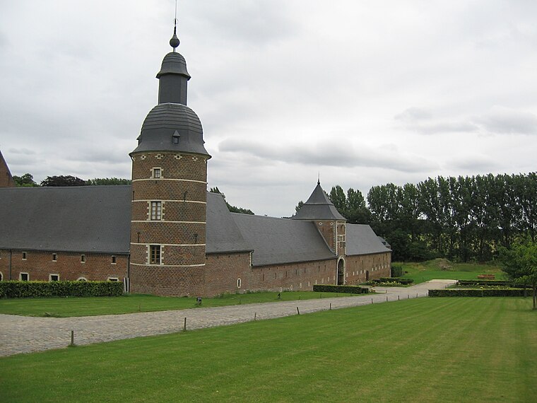
Photo: Grentidez, Public domain.
La Ramée Abbey is situated 1 km southeast of Église Sainte-Gertrude.
Tumulus of Glimes
Archaeological site

Photo: Varech, CC BY-SA 3.0.
Tumulus of Glimes is an archaeological site, which is situated 1¼ km southwest of Église Sainte-Gertrude.
Opprebais Castle

Photo: Varech, Public domain.
Opprebais Castle is a 13th-century fortified farmhouse in Opprebais, Wallonia, in the municipality of Incourt, Walloon Brabant, Belgium. Opprebais Castle is situated 3½ km west of Église Sainte-Gertrude.
Places in the Area
Nearby places include Jodoigne-Souveraine and Incourt.
Jodoigne-Souveraine
Village

Photo: Anakil, CC BY-SA 4.0.
Jodoigne-Souveraine is a village of Wallonia and a district of the municipality of Jodoigne, located in the province of Walloon Brabant, Belgium. The village lies next to the Great Gette.
Incourt
Village

Photo: Jean-Pol GRANDMONT, CC BY 3.0.
Incourt is a municipality of Wallonia located in the Belgian province of Walloon Brabant. On January 1, 2006, Incourt had a total population of 4,585. The total area is 38.79 km² which gives a population density of 118 inhabitants per km². Incourt is situated 3 km west of Église Sainte-Gertrude.
Mont-Saint-André
Village

Photo: Sonuwe, CC BY-SA 3.0.
Mont-Saint-André is a village, which is situated 4 km south of Église Sainte-Gertrude.
Église Sainte-Gertrude
- Type: Church
- Denomination: Catholic
- Categories: building, place of worship, and religion
- Location: Jodoigne, Arrondissement of Nivelles, Walloon Brabant, Wallonia, Belgium, Benelux, Europe
- View on OpenStreetMap
Latitude
50.68692° or 50° 41′ 13″ northLongitude
4.84381° or 4° 50′ 38″ eastOpen location code
9F26MRPV+QGOpenStreetMap ID
way 813669170OpenStreetMap feature
amenity=place_of_worshipOpenStreetMap feature
building=churchOpenStreetMap attribute
denomination=catholic
This page is based on OpenStreetMap, Wikidata, and Wikimedia Commons.
We’d love your help improving our open data sources. Thank you for contributing.
Satellite Map
Discover Église Sainte-Gertrude from above in high-definition satellite imagery.
Places with the Same Name
Discover other places named “Église Sainte-Gertrude”.
Notable Places Nearby
Highlights include terrain de sport du village and Ancienne école communale.
Nearby Places
Explore places such as Ancienne forge and Le Moulin des Saules.
Walloon Brabant: Must-Visit Destinations
Delve into Waterloo, Villers-la-Ville, and Louvain-la-Neuve.
Curious Churches to Discover
Uncover intriguing churches from every corner of the globe.
About Mapcarta. Data © OpenStreetMap contributors and available under the Open Database License". Text is available under the CC BY-SA 4.0 license, except for photos, directions, and the map. Photo: Myrabella, CC BY-SA 3.0.