Cameron Rocks War Memorial
Cameron Rocks War Memorial is a memorial in Brisbane, Queensland. Cameron Rocks War Memorial is situated nearby to the pier Newstead Pontoon, as well as near Electric tide recorder from 1959.| Tap on a place to explore it |
Places of Interest Nearby
Highlights include Newstead House and Holy Triad Temple.
Newstead House
Historic building
 Newstead House is Brisbane's oldest surviving residence and is located on the Breakfast Creek bank of the Brisbane River, in the northern Brisbane suburb of Newstead, in Queensland, Australia. Newstead House is situated 410 metres southwest of Cameron Rocks War Memorial.
Holy Triad Temple
Building

Photo: Kgbo, CC BY-SA 3.0.
The Holy Triad Temple is a heritage-listed temple at 32 Higgs Street, Albion, City of Brisbane, Queensland, Australia. It was built from 1885 to 1886. It is also known as Breakfast Creek Joss House and Sarm Sung Goon. Holy Triad Temple is situated 430 metres west of Cameron Rocks War Memorial.
Bowen Hills railway station
Railway station

Photo: TravellerQLD, CC BY-SA 3.0.
Bowen Hills railway station is located on the North Coast line in Queensland, Australia. It serves the Brisbane suburb of Bowen Hills. North of the station, the Ferny Grove line branches off. Bowen Hills railway station is situated 1¼ km southwest of Cameron Rocks War Memorial.
Places in the Area
Nearby places include Albion and Wooloowin.
Albion
Suburb
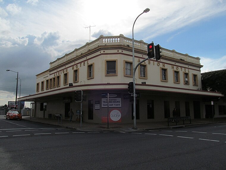
Photo: Orderinchaos, CC BY-SA 3.0.
Albion is an inner north-eastern suburb in the City of Brisbane, Queensland, Australia. In the 2021 census, Albion had a population of 3,446 people.
Wooloowin
Suburb
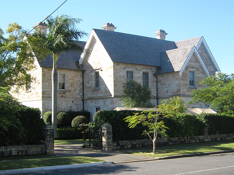
Photo: Gmcgarry, Public domain.
Wooloowin is a suburb in the City of Brisbane, Queensland, Australia. In the 2021 census, Wooloowin had a population of 4,029 people. Wooloowin is situated 2½ km north of Cameron Rocks War Memorial.
Hawthorne
Suburb
Hawthorne is a suburb of the City of Brisbane, Queensland, Australia. In the 2021 census, Hawthorne had a population of 5,090 people. Hawthorne is situated 2½ km southeast of Cameron Rocks War Memorial.
Cameron Rocks War Memorial
- Type: Memorial
- Roof shape: pyramidal
- Category: historic site
- Location: Brisbane, Queensland, Australia, Oceania
- View on OpenStreetMap
Latitude
-27.4404° or 27° 26′ 25″ southLongitude
153.04947° or 153° 2′ 58″ eastHeight
3 metres (9.8 feet)Open location code
5R4MH25X+RQOpenStreetMap ID
way 819016481OpenStreetMap feature
historic=memorialOpenStreetMap attribute
roof-shape=pyramidal
This page is based on OpenStreetMap, Wikidata, and Wikimedia Commons.
We’d love your help improving our open data sources. Thank you for contributing.
Satellite Map
Discover Cameron Rocks War Memorial from above in high-definition satellite imagery.
Notable Places Nearby
Highlights include Newstead Pontoon and Electric tide recorder from 1959.
Nearby Places
Explore places such as Kingsford Smith Dr at Cooksley Street, stop 14 and Kingsford Riverside Inn.
Queensland: Must-Visit Destinations
Delve into Brisbane, Gold Coast, Sunshine Coast, and Cairns.
Curious Memorials to Discover
Uncover intriguing memorials from every corner of the globe.
About Mapcarta. Data © OpenStreetMap contributors and available under the Open Database License". Text is available under the CC BY-SA 4.0 license, except for photos, directions, and the map. Photo: Wikimedia, CC0.