De Menapiers
De Menapiers is a building in Bruges, West Flanders, Flanders which is located on Sint-Jansdreef. De Menapiers is situated nearby to the playground Speeltuin Peter Benoitlaan, as well as near Speelplein Jan Breydellaan.| Tap on a place to explore it |
Places of Interest Nearby
Highlights include Belfry and Groeningemuseum.
Belfry

Photo: Jean-Pol GRANDMONT, CC BY-SA 4.0.
The Belfry of Bruges is a medieval bell tower in the centre of Bruges, Belgium. One of the city's most prominent symbols, the belfry formerly housed a treasury and the municipal archives and served as an observation post for spotting fires and other dangers. Belfry is situated 1¼ km east of De Menapiers.
Groeningemuseum
Museum
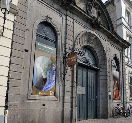
Photo: Le Fou, CC BY-SA 3.0.
The Groeningemuseum is a municipal museum in Bruges, Belgium, built on the site of the medieval Eekhout Abbey. It houses a collection of Flemish and Belgian painting covering six centuries, from Jan van Eyck to Marcel Broodthaers. Groeningemuseum is situated 1¼ km east of De Menapiers.
Graaf Visartpark
Park

Photo: MJJR, CC BY-SA 4.0.
Graaf Visartpark is situated 390 metres northeast of De Menapiers.
Places in the Area
Nearby places include Ezelstraatkwartier and Boeveriewijk.


De Menapiers
- Type: Building
- Address: Sint-Jansdreef 61, Sint-Andries, 8200
- Location: Bruges, Arrondissement of Bruges, West Flanders, Flanders, Belgium, Benelux, Europe
- View on OpenStreetMap
Latitude
51.20938° or 51° 12′ 34″ northLongitude
3.20837° or 3° 12′ 30″ eastLevels
2Operator
scoutingOpen location code
9F356655+Q8OpenStreetMap ID
way 847509881OpenStreetMap feature
building=yes
This page is based on OpenStreetMap, Wikidata, and Wikimedia Commons.
We’d love your help improving our open data sources. Thank you for contributing.
Satellite Map
Discover De Menapiers from above in high-definition satellite imagery.
Notable Places Nearby
Highlights include Speeltuin Peter Benoitlaan and Speelplein Jan Breydellaan.
Nearby Places
Explore places such as Kleuterschool Lenteweelde and B&B City Spa & Massage.
West Flanders: Must-Visit Destinations
Delve into Kortrijk, Ostend, Ypres, and Roeselare.
Curious Buildings to Discover
Uncover intriguing buildings from every corner of the globe.
About Mapcarta. Data © OpenStreetMap contributors and available under the Open Database License". Text is available under the CC BY-SA 4.0 license, except for photos, directions, and the map. Photo: MJJR, CC BY 3.0.