Hof ten Beygaerden
Hof ten Beygaerden is a building in Flanders, Belgium which is located on Hoogstraat. Hof ten Beygaerden is situated nearby to the nature reserve Volsembroek (Zuunvallei), as well as near De Weyden (Zuunvallei).| Tap on a place to explore it |
Places of Interest Nearby
Highlights include Sint-Pieterskerk and Kasteel Coloma.
Sint-Pieterskerk
Church
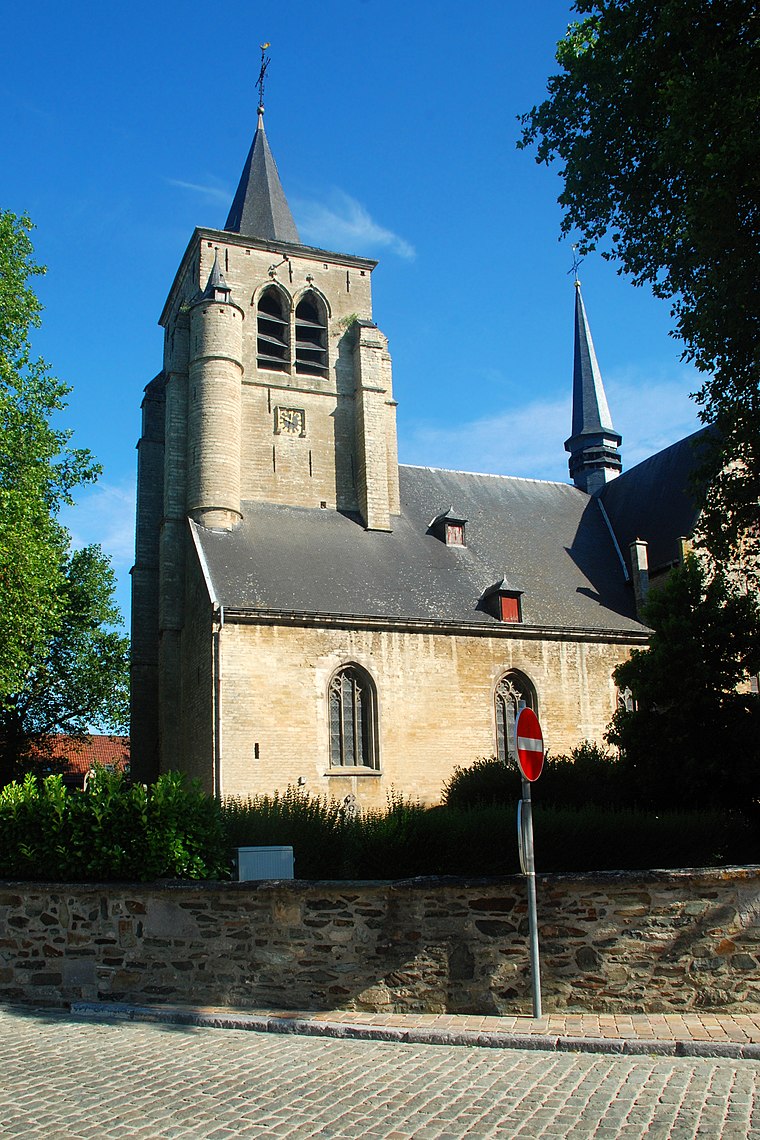
Photo: EmDee, CC BY-SA 3.0.
Sint-Pieterskerk is a church, which is situated 1½ km east of Hof ten Beygaerden.
Kasteel Coloma
Community center
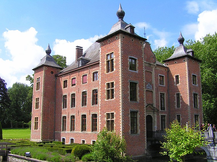 Kasteel Coloma is a community center, which is situated 2 km east of Hof ten Beygaerden.
Sint-Pietersbandenkerk
Church

Photo: Funkyxian, CC BY-SA 3.0.
Sint-Pietersbandenkerk is a church, which is situated 2 km west of Hof ten Beygaerden.
Places in the Area
Nearby places include Sint-Pieters-Leeuw and Oudenaken.
Sint-Pieters-Leeuw

Photo: Wouterhagens, CC BY-SA 4.0.
Sint-Pieters-Leeuw is a municipality in the province of Flemish Brabant, in the Flemish region of Belgium. The municipality comprises the towns of Oudenaken, Ruisbroek, Sint-Laureins-Berchem, Sint-Pieters-Leeuw proper and Vlezenbeek.
Vlezenbeek
Village
 Vlezenbeek is a small town of 3,324 in the Flemish Brabant southwest of Brussels, Belgium. It is part of the municipality Sint-Pieters-Leeuw. It is the home of Neuhaus, an international exporter of fine Belgian chocolate, as well as Lindemans Brewery, a brewery that produces lambics, a distinctly Belgian type of beer. Vlezenbeek is situated 3 km north of Hof ten Beygaerden.
Hof ten Beygaerden
Latitude
50.78265° or 50° 46′ 58″ northLongitude
4.2242° or 4° 13′ 27″ eastOpen location code
9F26Q6MF+3MOpenStreetMap ID
way 879887441OpenStreetMap feature
building=yes
This page is based on OpenStreetMap, Wikidata, and Wikimedia Commons.
We’d love your help improving our open data sources. Thank you for contributing.
Satellite Map
Discover Hof ten Beygaerden from above in high-definition satellite imagery.
Notable Places Nearby
Highlights include Volsembroek (Zuunvallei) and De Weyden (Zuunvallei).
Nearby Places
Explore places such as Sint-Pieters-Leeuw Volsembroek and Volsembroek (Zuunvallei).
Flanders: Must-Visit Destinations
Delve into Antwerp, Ghent, Bruges, and Sint-Truiden.
Curious Buildings to Discover
Uncover intriguing buildings from every corner of the globe.
About Mapcarta. Data © OpenStreetMap contributors and available under the Open Database License". Text is available under the CC BY-SA 4.0 license, except for photos, directions, and the map. Photo: Gf uip, CC BY-SA 3.0.