Moorteichwiese
Moorteichwiese is a playground in Kiel, Landeshauptstadt, Kiel, Schleswig-Holstein. Moorteichwiese is situated nearby to the government office Honorarkonsul des Königreiches Norwegen, as well as near Amt für Sportförderung.| Tap on a place to explore it |
Places of Interest Nearby
Highlights include Kiel Hauptbahnhof and Moorteichwiese.
Kiel Hauptbahnhof
Railway station
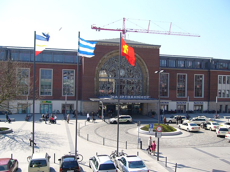
Photo: UphoffHe, Public domain.
Kiel Hauptbahnhof is the main railway station in the northern German city of Kiel. It consists of eight rail tracks and is a central hub for regional and long-distance passenger transport. Kiel Hauptbahnhof is situated 610 metres northeast of Moorteichwiese.

St. Jürgen Church
Church

Photo: Snoopy1964, CC BY-SA 4.0.
St. Jürgen Church is situated 290 metres north of Moorteichwiese.
Places in the Area
Nearby places include Gaarden-South and Kronsburg and Vorstadt.
Gaarden-South and Kronsburg
Locality

Photo: Wikimedia, CC BY-SA 3.0.
Gaarden-South and Kronsburg is a locality.


Moorteichwiese
- Type: Playground
- Category: recreation area
- Location: Kiel, Landeshauptstadt, Kiel, Kiel Bay, Schleswig-Holstein, Germany, Central Europe, Europe
- View on OpenStreetMap
Latitude
54.30969° or 54° 18′ 35″ northLongitude
10.12411° or 10° 7′ 27″ eastOperator
Landeshauptstadt KielOpen location code
9F6G845F+VJOpenStreetMap ID
way 912900152OpenStreetMap feature
leisure=playground
This page is based on OpenStreetMap, Wikidata, and Wikimedia Commons.
We’d love your help improving our open data sources. Thank you for contributing.
Satellite Map
Discover Moorteichwiese from above in high-definition satellite imagery.
Notable Places Nearby
Highlights include Honorarkonsul des Königreiches Norwegen and Amt für Sportförderung.
Nearby Places
Explore places such as Schule am Rondeel and WBS Training.
Kiel Bay: Must-Visit Destinations
Delve into Flensburg, Schleswig, Rendsburg, and Eckernförde.
Curious Playgrounds to Discover
Uncover intriguing playgrounds from every corner of the globe.
About Mapcarta. Data © OpenStreetMap contributors and available under the Open Database License". Text is available under the CC BY-SA 4.0 license, except for photos, directions, and the map. Photo: Ypsilon from Finland, CC0.