Prora
Prora is a farm in East Lothian, Scotland. Prora is situated nearby to the village Drem, as well as near the aerodrome East Fortune.| Tap on a place to explore it |
Places of Interest Nearby
Highlights include Drem railway station and Chesters Hill Fort.
Drem railway station
Railway station

Photo: ArtVandelay13, Public domain.
Drem railway station serves the small village of Drem in East Lothian, 5 miles from the seaside town of North Berwick in Scotland. It is located on the East Coast Main Line 18 miles east of Edinburgh Waverley. Drem railway station is situated 1 mile west of Prora.
Chesters Hill Fort

Photo: Renata, Public domain.
Chesters Hill Fort is an Iron Age hill fort in East Lothian, Scotland. It lies 1 mile south of Drem, 1+1⁄2 mi east of Ballencrieff Castle, 2+1⁄2 mi north of Haddington, and 2 mi west of Athelstaneford. Chesters Hill Fort is situated 1½ miles southwest of Prora.
East Fortune
Aerodrome

Photo: Kierant, CC BY-SA 3.0.
Royal Air Force East Fortune, or more simply RAF East Fortune, is a former Royal Air Force station located just south of the village of East Fortune. It is a short distance east of Edinburgh, in Scotland.
Places in the Area
Nearby places include Drem and East Fortune.
Drem
Village

Photo: Kevin Rae, CC BY-SA 2.0.
Drem is a small village in East Lothian, Scotland. It is approximately 20 miles east of Edinburgh and is close to Haddington, North Berwick, Dirleton and Gullane.
East Fortune
Hamlet

Photo: Wikimedia, CC BY-SA 2.0.
East Fortune is a village in East Lothian, Scotland, located 2 miles north west of East Linton. The area is known for its airfield which was constructed in 1915 to help protect Britain from attack by German Zeppelin airships during the First World War. East Fortune is situated 1½ miles east of Prora.
Athelstaneford
Village
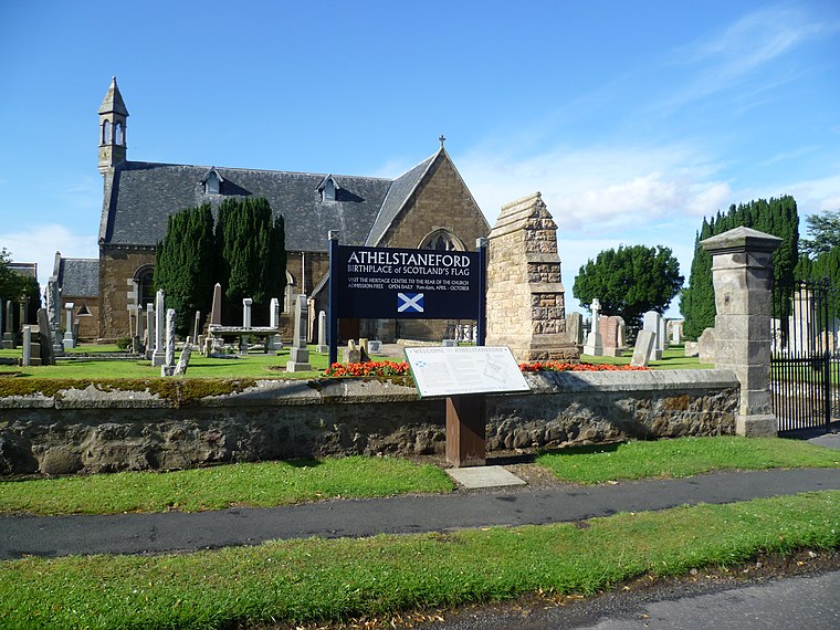
Photo: Kim Traynor, CC BY-SA 3.0.
Athelstaneford is a village in East Lothian, Scotland. It lies 3.5 miles north-east of the market town of Haddington and about 28 kilometres east of Edinburgh. Athelstaneford is situated 1½ miles southeast of Prora.
Prora
- Type: Farm
- Category: agriculture
- Location: East Lothian, Scotland, United Kingdom, Britain and Ireland, Europe
- View on OpenStreetMap
Latitude
56.00916° or 56° 0′ 33″ northLongitude
-2.76372° or 2° 45′ 49″ westOpen location code
9C8V265P+MGOpenStreetMap ID
way 914247750OpenStreetMap feature
landuse=farmyard
This page is based on OpenStreetMap, Wikidata, and Wikimedia Commons.
We’d love your help improving our open data sources. Thank you for contributing.
Satellite Map
Discover Prora from above in high-definition satellite imagery.
Places with the Same Name
Discover other places named “Prora”.
Notable Places Nearby
Highlights include Fenton Barns and Lodge, Fenton Barns.
Nearby Places
Explore places such as Prora and Drem Relay Room.
Scotland: Must-Visit Destinations
Delve into Edinburgh, Glasgow, Aberdeen, and Dundee.
Curious Farms to Discover
Uncover intriguing farms from every corner of the globe.
About Mapcarta. Data © OpenStreetMap contributors and available under the Open Database License". Text is available under the CC BY-SA 4.0 license, except for photos, directions, and the map. Photo: Ritchyblack, FAL.