Church Court
Church Court is a residential area in Broadstairs and St Peter’s, Thanet District, England. Church Court is situated nearby to the forest Mockett’s Wood, as well as near the cemetery Saint Peter-in-Thanet.| Tap on a place to explore it |
Places of Interest Nearby
Highlights include Broadstairs railway station and Roman Catholic Church of Our Lady Star of the Sea.
Broadstairs railway station
Railway station
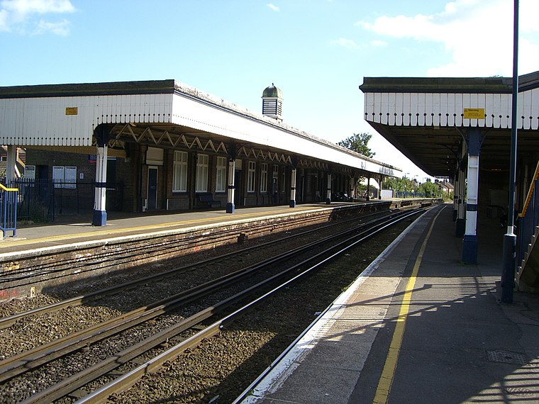
Photo: Atomicdanny, CC BY 3.0.
Broadstairs railway station is on the Chatham Main Line in England, serving the seaside town of Broadstairs, Kent. It is 77 miles 9 chains down the line from London Victoria and is situated between Margate and Dumpton Park. Broadstairs railway station is situated 4,100 feet southeast of Church Court.
Roman Catholic Church of Our Lady Star of the Sea
Church

Photo: Le Deluge, CC BY-SA 3.0.
Roman Catholic Church of Our Lady Star of the Sea is situated 3,300 feet southeast of Church Court.
The Charles Dickens School
School
The Charles Dickens School is a co-educational secondary modern school located in Broadstairs in the English county of Kent. The school is named after Charles Dickens, the 19th-century writer and social critic. The Charles Dickens School is situated 2,700 feet south of Church Court.
Places in the Area
Nearby places include St Peter’s and Broadstairs.
St Peter’s
Suburb
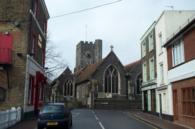
Photo: Graham Pritchard, CC BY-SA 2.0.
St Peter's is an area of Broadstairs, in the civil parish of Broadstairs and St Peter's, on the Isle of Thanet, in Kent, England. Historically a village, it was outgrown by the long-dominant settlement of the two, Broadstairs, after 1841.
Broadstairs

Photo: Acabashi, CC BY-SA 4.0.
Broadstairs is a beach resort on the east coast of Kent. It has sandy beaches, clean bathing water and a variety of pubs and restaurants. In 2021 its population was about 25,000.
Westwood
Village
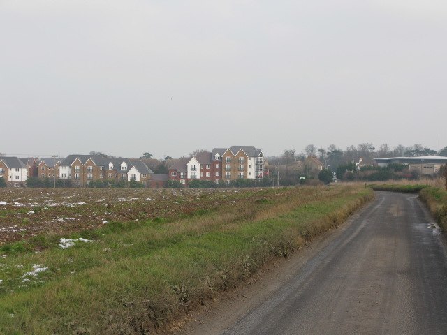
Photo: Nick Smith, CC BY-SA 2.0.
Westwood is a village and retail estate in Thanet district of Kent, England, and 1.9 miles south of Margate.
Church Court
Latitude
51.36732° or 51° 22′ 2″ northLongitude
1.41868° or 1° 25′ 7″ eastOperator
Sanctuary HousingOpen location code
9F339C89+WFOpenStreetMap ID
way 923127060OpenStreetMap feature
landuse=residential
This page is based on OpenStreetMap, Wikidata, and Wikimedia Commons.
We’d love your help improving our open data sources. Thank you for contributing.
Satellite Map
Discover Church Court from above in high-definition satellite imagery.
Places with the Same Name
Discover other places named “Church Court”.
Notable Places Nearby
Highlights include Mockett’s Wood and Saint Peter-in-Thanet.
Nearby Places
Explore places such as Mocketts Wood Surgery and The Co-op.
Kent: Must-Visit Destinations
Delve into Canterbury, Dover, Maidstone, and Rochester.
Curious Residential Areas to Discover
Uncover intriguing residential areas from every corner of the globe.
About Mapcarta. Data © OpenStreetMap contributors and available under the Open Database License". Text is available under the CC BY-SA 4.0 license, except for photos, directions, and the map. Photo: Diliff, CC BY-SA 3.0.