Kingsmead Way
Kingsmead Way is an apartment building in England, United Kingdom which is located on Kingsmead Way. Kingsmead Way is situated nearby to Westmead Garden, as well as near the park All-Mead Gardens.| Tap on a place to explore it |
Places of Interest Nearby
Highlights include London Stadium and Lee Valley VeloPark.
London Stadium
Stadium

Photo: Arne mueseler, CC BY-SA 3.0 de.
London Stadium is a multi-purpose outdoor stadium at Queen Elizabeth Olympic Park in the Stratford district of London. It is located in the Lower Lea Valley, 6 miles east of central London. London Stadium is situated 1¼ miles southeast of Kingsmead Way.
Lee Valley VeloPark
Stadium
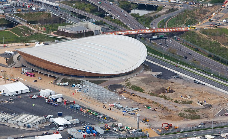 Lee Valley VeloPark is a cycling centre in Queen Elizabeth Olympic Park in Stratford, London, England. It is owned and managed by Lee Valley Regional Park Authority, and it was opened to the public in March 2014. Lee Valley VeloPark is situated 1 mile east of Kingsmead Way.
Homerton railway station
Railway station

Photo: Sunil060902, CC BY-SA 3.0.
Homerton is a station on the Mildmay line of the London Overground, located in the district of Homerton, East London. Situated in London fare zone 2, the current station opened on 13 May 1985 to coincide with the introduction of the Richmond to North Woolwich through electric passenger service. Homerton railway station is situated 2,600 feet southwest of Kingsmead Way.
Places in the Area
Nearby places include Homerton and Hackney Wick.
Homerton
Suburb

Photo: Chris Whippet, CC BY-SA 2.0.
Homerton is an area in London, England, in the London Borough of Hackney. It is bordered to the west by Hackney Central, to the north by Lower Clapton, in the east by Hackney Wick, Leyton and by South Hackney to the south.
Hackney Wick
Suburb

Photo: Nigel Chadwick, CC BY-SA 2.0.
Hackney Wick is a neighbourhood in East London, England. The area forms the south-eastern part of the district of Hackney, and also of the wider London Borough of Hackney.
Hackney
Suburb

Photo: tony duell, CC BY 2.0.
Hackney was a parish in the historic county of Middlesex. The parish church of St John-at-Hackney was built in 1792, replacing the nearby former 16th-century parish church dedicated to St Augustine.
Kingsmead Way
- Type: Apartment building
- Address: 11 Kingsmead Way
- Categories: building and residential building
- Location: England, United Kingdom, Britain and Ireland, Europe
- View on OpenStreetMap
Latitude
51.55191° or 51° 33′ 7″ northLongitude
-0.03483° or 0° 2′ 5″ westLevels
3Open location code
9C3XHX28+Q3OpenStreetMap ID
way 923395586OpenStreetMap feature
building=apartments
This page is based on OpenStreetMap, Wikidata, and Wikimedia Commons.
We’d love your help improving our open data sources. Thank you for contributing.
Satellite Map
Discover Kingsmead Way from above in high-definition satellite imagery.
Notable Places Nearby
Highlights include Westmead Garden and All-Mead Gardens.
Nearby Places
Explore places such as Silverfields Pharmacy and Kingsmead House.
England: Must-Visit Destinations
Delve into London, Manchester, Sheffield, and Leeds.
Curious Apartment Buildings to Discover
Uncover intriguing apartment buildings from every corner of the globe.
About Mapcarta. Data © OpenStreetMap contributors and available under the Open Database License". Text is available under the CC BY-SA 4.0 license, except for photos, directions, and the map. Photo: sidibousaid, CC BY 2.0.