Walton Grounds Farmhouse
Walton Grounds Farmhouse is a residential area in Aynhoe Park, South Northamptonshire District, England. Walton Grounds Farmhouse is situated nearby to the village Aynho, as well as near King’s Sutton.| Tap on a place to explore it |
Places of Interest Nearby
Highlights include St Michael’s Church, Aynho and Church of St Peter and St Paul, Kings Sutton.
St Michael’s Church, Aynho
Church

Photo: Steve Daniels, CC BY-SA 2.0.
St Michael's Church is a Grade I listed church in Aynho, Northamptonshire. St Michael’s Church, Aynho is situated 1 mile southeast of Walton Grounds Farmhouse.
Church of St Peter and St Paul, Kings Sutton
Church
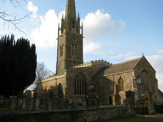
Photo: Kurt C, CC BY-SA 2.0.
Church of St Peter and St Paul, Kings Sutton is situated 1¼ miles northwest of Walton Grounds Farmhouse.
The Cartwright Arms Hotel
Hotel

Photo: canalandriversidepubs co uk, CC BY-SA 2.0.
The Cartwright Arms Hotel is situated 1 mile southeast of Walton Grounds Farmhouse.
Places in the Area
Nearby places include Aynho and King’s Sutton.
Aynho
Village
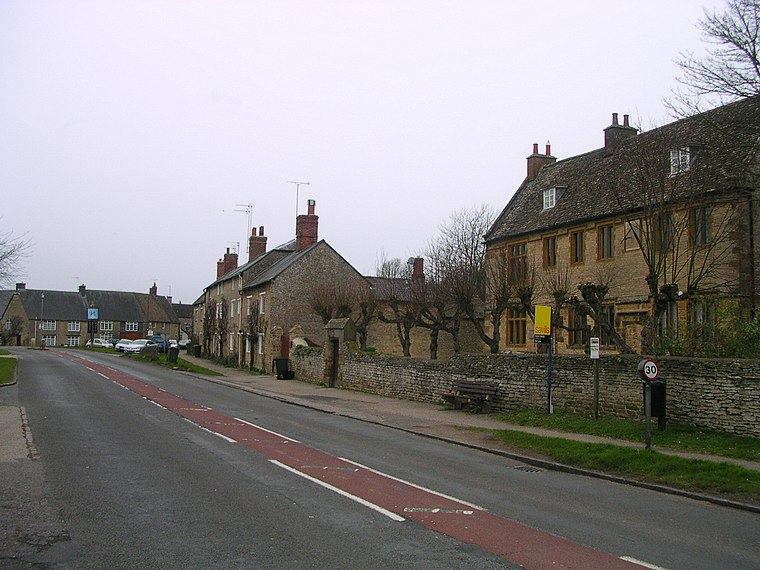
Photo: Charlesdrakew, Public domain.
Aynho is a village and civil parish in West Northamptonshire, England, on the edge of the Cherwell valley 6 miles south-east of the north Oxfordshire town of Banbury and 7 miles southwest of Brackley.
King’s Sutton
Village
King's Sutton is a village and civil parish in West Northamptonshire, Northamptonshire, England, in the valley of the River Cherwell. It is sited about 4.1 miles south-east of Banbury, Oxfordshire.
Charlton
Village

Photo: Julian Dowse, CC BY-SA 2.0.
Charlton is a village in the parish of Newbottle, Northamptonshire, England. Situated between Brackley and Kings Sutton, lying close to a small tributary of the River Cherwell. Charlton is situated 1½ miles northeast of Walton Grounds Farmhouse.
Walton Grounds Farmhouse
Latitude
52.00641° or 52° 0′ 23″ northLongitude
-1.26377° or 1° 15′ 50″ westOpen location code
9C4W2P4P+HFOpenStreetMap ID
way 924336483OpenStreetMap feature
landuse=residential
This page is based on OpenStreetMap, Wikidata, and Wikimedia Commons.
We’d love your help improving our open data sources. Thank you for contributing.
Satellite Map
Discover Walton Grounds Farmhouse from above in high-definition satellite imagery.
Notable Places Nearby
Highlights include Rose Cottage and College Farm.
Nearby Places
Explore places such as Scotts House and Walton Grounds.
England: Must-Visit Destinations
Delve into London, Manchester, Sheffield, and Leeds.
Curious Residential Areas to Discover
Uncover intriguing residential areas from every corner of the globe.
About Mapcarta. Data © OpenStreetMap contributors and available under the Open Database License". Text is available under the CC BY-SA 4.0 license, except for photos, directions, and the map. Photo: sidibousaid, CC BY 2.0.