Confrérie Notre-Dame de Tongre
Confrérie Notre-Dame de Tongre is a building in Chièvres, Arrondissement of Ath, Wallonia. Confrérie Notre-Dame de Tongre is situated nearby to the church Basilique Notre-Dame de Tongre, as well as near the grassland Pelouse de dispersion.| Tap on a place to explore it |
Places of Interest Nearby
Highlights include Ormeignies Communal Cemetery and Château Malaise.
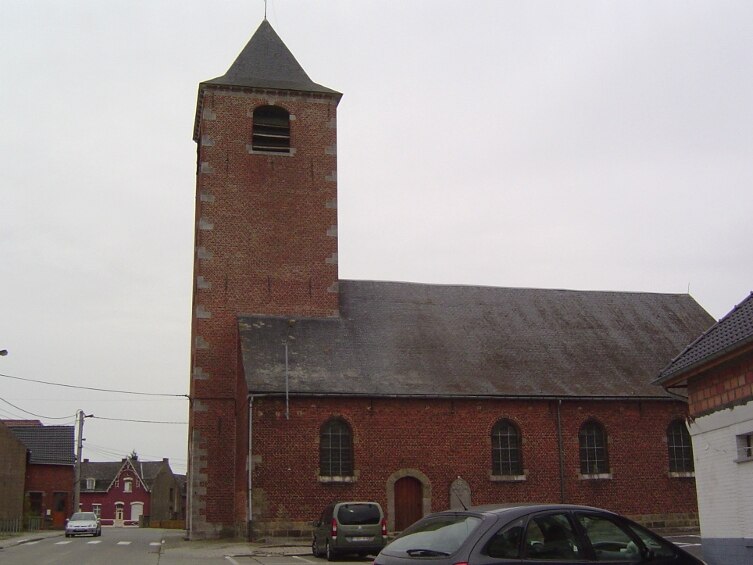
Ormeignies Communal Cemetery
Cemetery

Photo: Wernervc, CC BY-SA 4.0.
Ormeignies Communal Cemetery is situated 2 km northwest of Confrérie Notre-Dame de Tongre.
Château Malaise
Castle

Photo: Wikimedia, Public domain.
Château Malaise is a castle, which is situated 3½ km southwest of Confrérie Notre-Dame de Tongre.
Arbre Viaduct
Bridge

Photo: Michielverbeek, CC BY-SA 3.0.
Arbre Viaduct is a bridge, which is situated 3½ km northeast of Confrérie Notre-Dame de Tongre.
Places in the Area
Nearby places include Huissignies and Ath.
Ath

Photo: Daniel71953, CC BY-SA 3.0.
Ath is a French-speaking town of about 30,000 inhabitants in the centre of western Hainaut, mid-way between Brussels and Lille in France. Famous for the annual Ducasse festival, this typically Belgian small town with architecture from different eras can make a nice daytrip from Brussels or Lille.
Attre
Village

Photo: Jean-Pol GRANDMONT, CC BY 2.5.
Attre is a village, which is situated 6 km northeast of Confrérie Notre-Dame de Tongre.
Confrérie Notre-Dame de Tongre
- Type: Building
- Denomination: Roman Catholic
- Location: Chièvres, Arrondissement of Ath, Hainaut, Wallonia, Belgium, Benelux, Europe
- View on OpenStreetMap
Latitude
50.58188° or 50° 34′ 55″ northLongitude
3.77499° or 3° 46′ 30″ eastOpen location code
9F25HQJF+PXOpenStreetMap ID
way 926327612OpenStreetMap feature
building=yesOpenStreetMap attribute
denomination=roman_catholic
This page is based on OpenStreetMap, Wikidata, and Wikimedia Commons.
We’d love your help improving our open data sources. Thank you for contributing.
Satellite Map
Discover Confrérie Notre-Dame de Tongre from above in high-definition satellite imagery.
Notable Places Nearby
Highlights include Basilique Notre-Dame de Tongre and Pelouse de dispersion.
Nearby Places
Explore places such as Centre Marial de Tongre-Notre-Dame and Tongre-Notre-Dame Rue Tour de la Vierge.
Hainaut: Must-Visit Destinations
Delve into Charleroi, Mons, Tournai, and La Louvière.
Curious Buildings to Discover
Uncover intriguing buildings from every corner of the globe.
About Mapcarta. Data © OpenStreetMap contributors and available under the Open Database License". Text is available under the CC BY-SA 4.0 license, except for photos, directions, and the map. Photo: Bebob2009, CC BY-SA 3.0.