Forthside Car Park
Forthside Car Park is a parking area in Stirling, Scotland. Forthside Car Park is situated nearby to the movie theater Vue, as well as near the military installation Forthside Barracks.| Tap on a place to explore it |
Places of Interest Nearby
Highlights include Stirling railway station and Forthside Barracks.
Stirling railway station
Railway station

Photo: Andrew Abbott, CC BY-SA 2.0.
Stirling railway station is a railway station located in Stirling, Scotland. It is located on the former Caledonian Railway main line between Glasgow and Perth. Stirling railway station is situated 1,400 feet northwest of Forthside Car Park.
Forthside Barracks
Military installation

Photo: Richard Webb, CC BY-SA 2.0.
Forthside Barracks is a former military installation in Stirling, Scotland. Forthside Barracks is situated 550 feet southeast of Forthside Car Park.
Stirling Castle
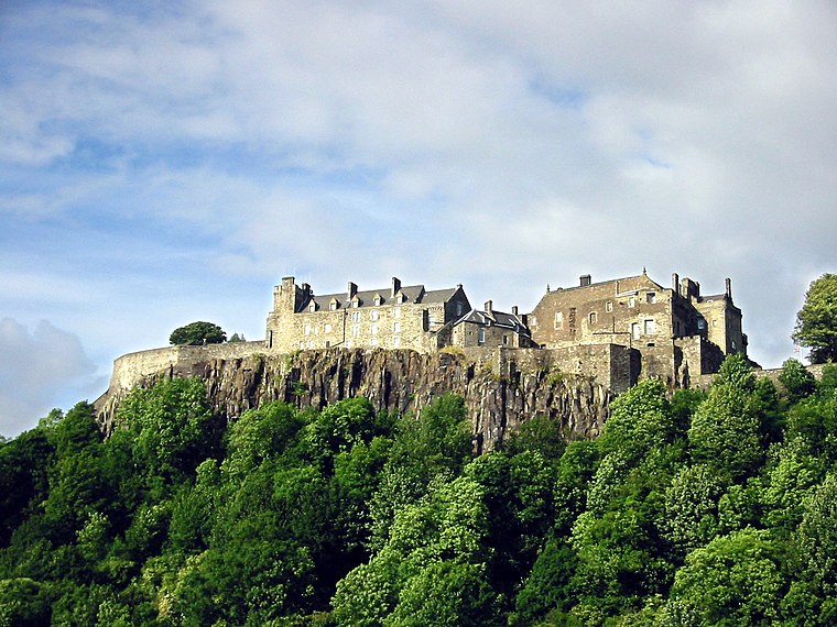
Photo: Wikimedia, CC BY-SA 3.0.
Stirling Castle, located in Stirling, is one of the largest and most historically and architecturally important castles in Scotland. The castle sits atop an intrusive crag, which forms part of the Stirling Sill geological formation. Stirling Castle is situated 1 mile northwest of Forthside Car Park.
Places in the Area
Nearby places include Stirling and Cambuskenneth.
Stirling

Photo: AlasdairW, CC BY-SA 3.0.
Stirling is a city in the central lowlands of Scotland, and historically the county town of Stirlingshire. For centuries this was the main route between the Highlands and the Lowlands, guarded by the castle on its battleship of a crag, and with the River Forth sweeping round as a moat.
Cambuskenneth
Village

Photo: Mike Pennington, CC BY-SA 2.0.
Cambuskenneth is a village in the city of Stirling, Scotland. It has a population of 250 and is the site of the historic Cambuskenneth Abbey. It is situated by the River Forth and the only road access to the village is along Ladysneuk Road from Alloa Road in Causewayhead.
Torbrex Village
Suburb

Photo: Richard Webb, CC BY-SA 2.0.
Torbrex is an area in the southwest of Stirling, Scotland, which developed around a small weaving village. It is neighboured by Cambusbarron to the west, St. Ninians to the south, Livilands to the east and Kenningknowes and Laurelhill to the north.
Forthside Car Park
- Type: Parking area
- Category: transportation
- Location: Stirling, Scotland, United Kingdom, Britain and Ireland, Europe
- View on OpenStreetMap
Latitude
56.11762° or 56° 7′ 3″ northLongitude
-3.92863° or 3° 55′ 43″ westOperator
Stirling CouncilOpen location code
9C8R439C+2GOpenStreetMap ID
way 98588851OpenStreetMap feature
amenity=parking
This page is based on OpenStreetMap, Wikidata, and Wikimedia Commons.
We’d love your help improving our open data sources. Thank you for contributing.
Satellite Map
Discover Forthside Car Park from above in high-definition satellite imagery.
Notable Places Nearby
Highlights include Vue and Former MOD Forthside.
Nearby Places
Explore places such as Gabe’s Diner and Premier Inn.
Scotland: Must-Visit Destinations
Delve into Edinburgh, Glasgow, Aberdeen, and Dundee.
Curious Parking Areas to Discover
Uncover intriguing parking areas from every corner of the globe.
About Mapcarta. Data © OpenStreetMap contributors and available under the Open Database License". Text is available under the CC BY-SA 4.0 license, except for photos, directions, and the map. Photo: Ritchyblack, FAL.