St Sophia’s Primary School
St Sophia’s Primary School is a school in East Ayrshire, Scotland which is located on Nelville Drive. St Sophia’s Primary School is situated nearby to Portland Park, as well as near the community center Hogg Hall.| Tap on a place to explore it |
- Email: elizabeth.heron@eastayrshire.org.uk
- Type: School
- Denomination: Roman Catholic
- Address: Nelville Drive, KA4 8BN
Places of Interest Nearby
Highlights include Barr Castle and St Sophia’s Church (Galston).
Barr Castle
Castle
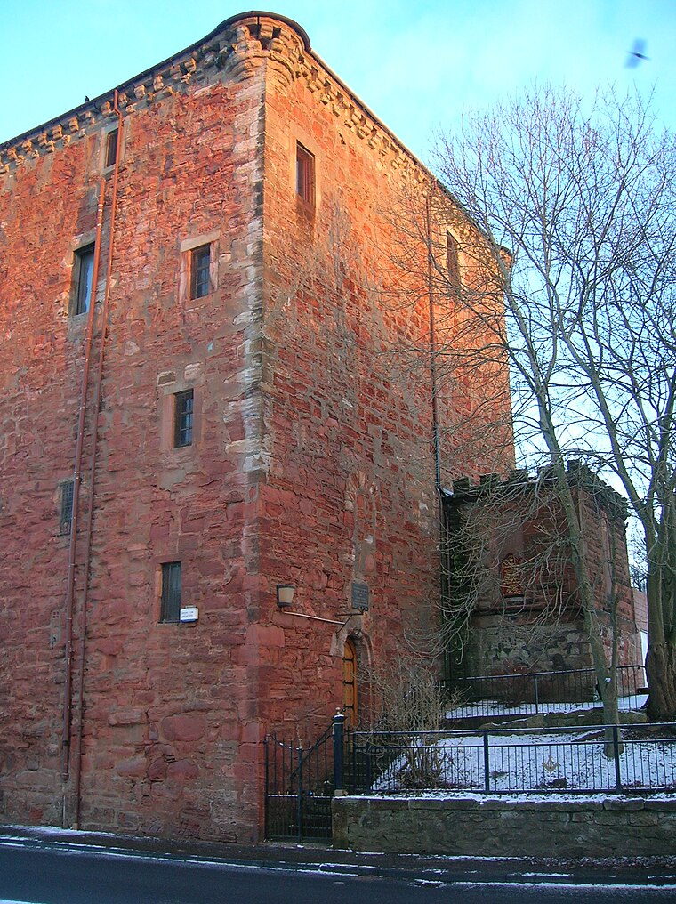
Photo: Rosser1954, CC BY-SA 3.0.
Galston is a town in East Ayrshire, Scotland, which has a population of 4,710 and is at the heart of the civil parish of the same name. It is situated in wooded countryside four miles upriver from Kilmarnock and is one a group of the small towns located in the Irvine Valley between the towns of Hurlford and Newmilns. Barr Castle is situated 2,400 feet east of St Sophia’s Primary School.
St Sophia’s Church (Galston)
Church

Photo: Dan, CC BY-SA 2.0.
St Sophia’s Church (Galston) is situated 2,900 feet east of St Sophia’s Primary School.
Loudoun Kirk
Church

Photo: Rosser1954, CC BY-SA 3.0.
Loudoun Kirk is a disused church located about one mile west of Loudoun Castle, East Ayrshire. It served as Loudoun's parish church until some point after 1600, when this function moved to the church in nearby Newmilns. Loudoun Kirk is situated 2,800 feet north of St Sophia’s Primary School.
Places in the Area
Nearby places include Galston and Moscow.
Galston
Town

Photo: Wikimedia, Public domain.
Galston is a town in East Ayrshire, Scotland, which has a population of 4,710 and is at the heart of the civil parish of the same name. It is situated in wooded countryside four miles upriver from Kilmarnock and is one a group of the small towns located in the Irvine Valley between the towns of Hurlford and Newmilns.
Moscow
Village

Photo: Nicholas Mutton, CC BY-SA 2.0.
Moscow is a hamlet in East Ayrshire in Scotland. It is on the A719 road some 4 miles east of Kilmarnock. In 2006 its population was reported as 118. It is represented in the "Galston West and Hurlford North" ward of East Ayrshire Council. Moscow is situated 2½ miles north of St Sophia’s Primary School.
Hurlford
Village

Photo: Gordon Brown, CC BY-SA 2.0.
Hurlford is a village in East Ayrshire, Scotland, situated on the outskirts of Kilmarnock, the largest and administrative centre of East Ayrshire and East Ayrshire Council. Hurlford is situated 2½ miles west of St Sophia’s Primary School.
St Sophia’s Primary School
- Category: education
- Location: East Ayrshire, Scotland, United Kingdom, Britain and Ireland, Europe
- View on OpenStreetMap
Latitude
55.59918° or 55° 35′ 57″ northLongitude
-4.39155° or 4° 23′ 30″ westOperator
East Ayrshire CouncilOpen location code
9C7QHJX5+M9OpenStreetMap ID
way 98876165OpenStreetMap feature
amenity=schoolOpenStreetMap attribute
denomination=roman_catholic
This page is based on OpenStreetMap, Wikidata, and Wikimedia Commons.
We’d love your help improving our open data sources. Thank you for contributing.
Satellite Map
Discover St Sophia’s Primary School from above in high-definition satellite imagery.
Notable Places Nearby
Highlights include Portland Park and Hogg Hall.
Nearby Places
Explore places such as Galston Primary School and Goatfoot Colliery.
Scotland: Must-Visit Destinations
Delve into Edinburgh, Glasgow, Aberdeen, and Dundee.
Curious Schools to Discover
Uncover intriguing schools from every corner of the globe.
About Mapcarta. Data © OpenStreetMap contributors and available under the Open Database License". Text is available under the CC BY-SA 4.0 license, except for photos, directions, and the map. Photo: Ritchyblack, FAL.