Wickford
Wickford is a town and civil parish in the south of the English county of Essex, with a population of 33,486. Located approximately 30 miles east of London, it is within the Borough of Basildon along with the original town of Basildon, Billericay, Laindon and Pitsea.| Tap on a place to explore it |
Photo: Trevor Harris, CC BY-SA 2.0.
Photo: Glyn Baker, CC BY-SA 2.0.
Photo: R28B, Public domain.
Places of Interest
Highlights include Wickford railway station and The Bromfords School.
Wickford railway station
Railway station

Photo: Wykebjs, Public domain.
Wickford railway station is a junction stop on the Shenfield to Southend Line and also the western terminus of the Crouch Valley Line in the east of England, serving the town of Wickford in the Basildon district of Essex.
The Bromfords School
School
The Bromfords School is a coeducational secondary school and sixth form with academy status, located in Wickford, Essex, England. Most pupils live in Wickford, while a large minority of pupils live in nearby Basildon and other neighbouring towns.
Beauchamps High School
School
Beauchamps High School is a mixed intake secondary school and sixth form for students aged between 11 and 18 in Wickford, Essex, England. The sixth form offers post 16 education for students aged 16–18 and accepts both former Beauchamps students and students educated at other establishments.
Places in the Area
Nearby places include North Benfleet and Downham.
North Benfleet
Village
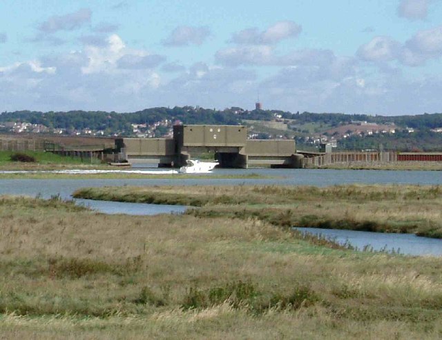
Photo: Glyn Baker, CC BY-SA 2.0.
North Benfleet is a village and former civil parish, now in the parish of Bowers Gifford and North Benfleet, in the Basildon district of Essex, England, located between the towns of Basildon to the west and South Benfleet to the east. North Benfleet is situated 2 miles south of Wickford.
Downham
Village

Photo: Glyn Baker, CC BY-SA 2.0.
Downham is a small village and former civil parish, now in the parish of South Hanningfield, in the City of Chelmsford district, Essex, England. It is located approximately 7 miles south of the county town of Chelmsford. Downham is situated 2 miles northwest of Wickford.
Crays Hill
Village

Photo: Glyn Baker, CC BY-SA 2.0.
Crays Hill is a village in the Basildon borough of Essex, England, twinned with the city of Leeds, West Yorkshire. The River Crouch passes under Church Lane. Crays Hill is situated 2½ miles west of Wickford.
Wickford
- Type: Town with 33,000 residents
- Description: town in Essex, England
- Categories: unparished area, civil parish, and locality
- Location: Borough of Basildon, Essex, East of England, England, United Kingdom, Britain and Ireland, Europe
- View on OpenStreetMap
Latitude
51.6114° or 51° 36′ 41″ northLongitude
0.5244° or 0° 31′ 28″ eastPopulation
33,000Elevation
26 feet (8 metres)United Nations Location Code
GB WIDOpen location code
9F32JG6F+HQOpenStreetMap ID
node 26500288OpenStreetMap feature
place=town
This page is based on OpenStreetMap, GeoNames, Wikidata, Wikimedia Commons, and Wikipedia.
We’d love your help improving our open data sources. Thank you for contributing.
Satellite Map
Discover Wickford from above in high-definition satellite imagery.
In Other Languages
From Afrikaans to Welsh—“Wickford” goes by many names.
- Afrikaans: “Wickford”
- Asturian: “Wickford”
- Basque: “Wickford”
- Cebuano: “Wickford”
- Chinese: “威克福德”
- Dutch: “Wickford”
- French: “Wickford”
- German: “Wickford”
- Irish: “Wickford”
- Italian: “Wickford”
- Japanese: “ウィックフォード”
- Ladin: “Wickford”
- Norwegian Nynorsk: “Wickford”
- Persian: “ویکفورد”
- Polish: “Wickford”
- Romanian: “Wickford”
- Scots: “Wickford”
- Spanish: “Wickford”
- Swedish: “Wickford”
- Turkish: “Wickford”
- Volapük: “Wickford”
- Welsh: “Wickford”
Places with the Same Name
Discover other places named “Wickford”.
Localities in the Area
Explore places such as Shotgate and Runwell.
Essex: Must-Visit Destinations
Delve into Colchester, Chelmsford, Southend-on-Sea, and Basildon.
Explore These Curated Destinations
Discover places selected for their distinct character and enduring appeal.
About Mapcarta. Data © OpenStreetMap contributors and available under the Open Database License". Text is available under the CC BY-SA 4.0 license, except for photos, directions, and the map. Description text is based on the Wikipedia page “Wickford”. Photo: Trevor Harris, CC BY-SA 2.0.