206 Santa Isabel sur
206 Santa Isabel sur is a bus stop in Los Martires, Bogotá D.C., Bogotá and has an elevation of 2,602 metres. 206 Santa Isabel sur is situated nearby to the suburb Antonio Nariño, as well as near Los Mártires.| Tap on a place to explore it |
Places of Interest Nearby
Highlights include Gold Museum and Casa de Nariño.
Gold Museum
Museum
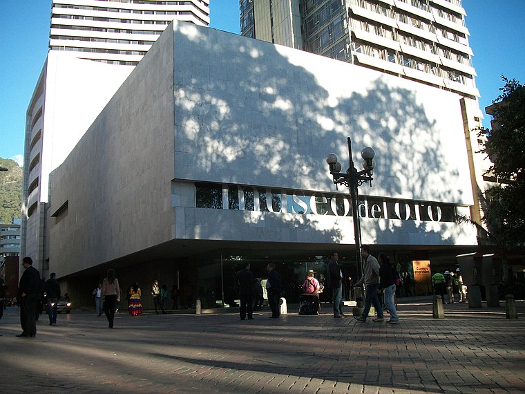
Photo: Pedro Felipe, CC BY-SA 3.0.
The Museum of Gold is an archaeology museum located in Bogotá, Colombia. It is one of the most visited touristic highlights in the country. The museum receives around 500,000 tourists per year. Gold Museum is situated 3 km east of 206 Santa Isabel sur.
Casa de Nariño
Government office
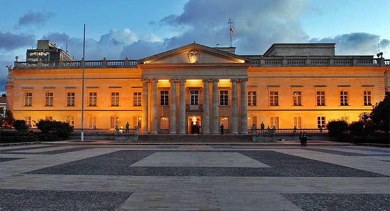
Photo: Juanjo70000, CC BY-SA 4.0.
The Casa de Nariño, literally the House of Nariño, is the official residence and principal workplace of the President of Colombia. It houses the main office of the executive branch and is located in the capital city of Bogotá, Colombia. Casa de Nariño is situated 2½ km east of 206 Santa Isabel sur.
SENA
Bus station

Photo: EEIM, CC BY-SA 3.0.
The simple station SENA is part of the TransMilenio mass-transit system of Bogotá, Colombia, opened in the year 2000. SENA is situated 1¼ km west of 206 Santa Isabel sur.
Places in the Area
Nearby places include Santa Fé-Los Mártires and Antonio Nariño.
Santa Fé-Los Mártires

Photo: Pedro Felipe, CC BY-SA 3.0.
Santa Fé is the traditional downtown of Bogotá, surrounding the historic district of La Candelaria. Los Mártires is the western end of downtown, and more rarely visited by foreigners, except to check out its sketchy market for extremely good deals.
Antonio Nariño
Suburb

Photo: Pedro Felipe, CC BY-SA 4.0.
Antonio Nariño is the 15th locality of Bogotá, capital of Colombia. It is located in the central part of the city. This district is mostly inhabited by middle class residents.
Los Mártires
Suburb

Photo: Pedro Felipe, CC BY-SA 3.0.
Los Mártires is the 14th locality of Bogotá, capital of Colombia. It is located near the city's downtown to its west. This district is mostly inhabited by lower middle and working class residents.
206 Santa Isabel sur
- Type: Bus stop
- Also known as: “Santa Isabel sur”
- Category: transportation
- Location: Los Martires, Bogotá D.C., Bogotá, Andino, Colombia, South America
- View on OpenStreetMap
Latitude
4.59781° or 4° 35′ 52″ northLongitude
-74.0998° or 74° 5′ 59″ westElevation
2,602 metres (8,537 feet)Operator
SITPNetwork
co:dc:sitpOpen location code
67P7HWX2+43OpenStreetMap ID
node 3867881229OpenStreetMap feature
highway=bus_stopOpenStreetMap feature
public_transport=platformGeoNames ID
10859615
This page is based on OpenStreetMap, GeoNames, Wikidata, and Wikimedia Commons.
We’d love your help improving our open data sources. Thank you for contributing.
Satellite Map
Discover 206 Santa Isabel sur from above in high-definition satellite imagery.
Localities in the Area
Explore places such as UPZ Santa Isabel and La Fragüita.
Nearby Places
Explore places such as Santa Isabel sur and Paga Todo.
Bogotá: Must-Visit Destinations
Delve into La Candelaria, Zona Rosa, Santa Fé-Los Mártires, and Usaquén.
Curious Bus Stops to Discover
Uncover intriguing bus stops from every corner of the globe.
About Mapcarta. Data © OpenStreetMap contributors and available under the Open Database License". Text is available under the CC BY-SA 4.0 license, except for photos, directions, and the map. Photo: Wikimedia, CC BY-SA 3.0.