Rob Roy’s putting stone
Rob Roy’s putting stone is a stone in Stirling, Scotland. Rob Roy’s putting stone is situated nearby to the peak Meall an Fhiodhain, as well as near Meall an t-Seallaidh - Cam Chreag.| Tap on a place to explore it |
Places of Interest Nearby
Highlights include Meall an t-Seallaidh - Cam Chreag and Meall an t-Seallaidh.
Meall an t-Seallaidh - Cam Chreag
Peak

Photo: Lis Burke, CC BY-SA 2.0.
Meall an t-Seallaidh - Cam Chreag is a peak.
Meall an t-Seallaidh
Peak

Photo: wfmillar, CC BY-SA 2.0.
Meall an t-Seallaidh is a mountain in the Southern Highlands of Scotland. It is located in the Loch Lomond and The Trossachs National Park, west of Loch Earn. The mountain rises steeply from the village of Balquhidder. Meall an t-Seallaidh is situated 1½ miles east of Rob Roy’s putting stone.
Balquhidder Parish Church, Balquhidder
Church

Photo: Raymond Chisholm, CC BY-SA 2.0.
Balquhidder Parish Church, Balquhidder is situated 2½ miles southeast of Rob Roy’s putting stone.
Places in the Area
Nearby places include Balquhidder and Ardchyle.
Balquhidder
Village

Photo: Alireid, Public domain.
Balquhidder is a small village in Perthshire located 10 miles north-west of Callander. It is administered by the Stirling council area of Scotland and is overlooked by the dramatic mountain terrain of the "Braes of Balquhidder", at the head of Loch Voil. Balquhidder is situated 2½ miles southeast of Rob Roy’s putting stone.
Ardchyle
Hamlet
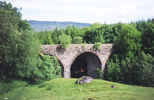
Photo: Wikimedia, CC BY-SA 2.0.
Ardchyle is a small hamlet in Stirling, Scotland. The Glendhu viaduct, just south of Ardchyle, was built for the now disused section of the Callander and Oban Railway which closed in 1965 after a landslide. Ardchyle is situated 3 miles north of Rob Roy’s putting stone.
Auchlyne
Hamlet

Photo: Dave Fergusson, CC BY-SA 2.0.
Auchlyne is a small hamlet in Stirling, Scotland. It is located approximately five miles west of Killin on Loch Tay, off the main A85 road that runs from Perth to Oban. Auchlyne is situated 3 miles north of Rob Roy’s putting stone.
Rob Roy’s putting stone
- Type: Stone
- Category: landform
- Location: Stirling, Scotland, United Kingdom, Britain and Ireland, Europe
- View on OpenStreetMap
Latitude
56.38792° or 56° 23′ 17″ northLongitude
-4.40465° or 4° 24′ 17″ westOpen location code
9C8Q9HQW+54OpenStreetMap ID
node 11598626661OpenStreetMap feature
natural=stone
This page is based on OpenStreetMap, Wikidata, and Wikimedia Commons.
We’d love your help improving our open data sources. Thank you for contributing.
Satellite Map
Discover Rob Roy’s putting stone from above in high-definition satellite imagery.
Notable Places Nearby
Highlights include Meall an Fhiodhain and Creag Ghlas.
Nearby Places
Explore places such as Lochan an Eireannaich and Scottish Water.
Scotland: Must-Visit Destinations
Delve into Edinburgh, Glasgow, Aberdeen, and Dundee.
Curious Stones to Discover
Uncover intriguing stones from every corner of the globe.
About Mapcarta. Data © OpenStreetMap contributors and available under the Open Database License". Text is available under the CC BY-SA 4.0 license, except for photos, directions, and the map. Photo: Ritchyblack, FAL.