Pant-y-drain
Pant-y-drain is a locality in Llangurig, Powys, Wales. Pant-y-drain is situated nearby to the locality Tan-y-berth, as well as near Lluest Cerdin.| Tap on a place to explore it |
Places of Interest
Highlights include Black Lion Hotel.
Black Lion Hotel
Pub
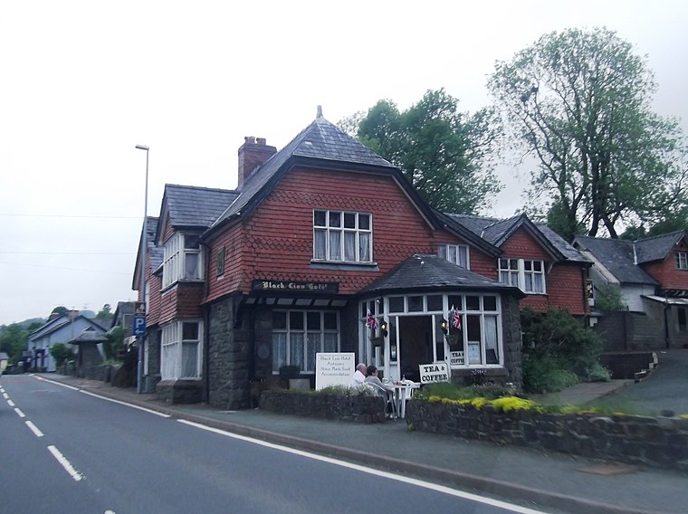
Photo: Anthony Parkes, CC BY-SA 2.0.
Black Lion Hotel is a pub, which is situated 2½ miles north of Pant-y-drain.
Places in the Area
Nearby places include Llangurig and St Harmon.
Llangurig
Village

Photo: David Purchase, CC BY-SA 2.0.
Llangurig is a village and community in Montgomeryshire, Powys, Wales. The population was 723 in the 2011 UK Census. The community includes the hamlet of Cwmbelan. Llangurig is situated 2½ miles north of Pant-y-drain.
St Harmon
Village

Photo: Eirian Evans, CC BY-SA 2.0.
St Harmon is a village and community in Radnorshire, Powys, Wales. The population of the community at the 2011 census was 593. It is located on the Afon Marteg on the B4518 road running between Llanidloes and Rhayader. St Harmon is situated 5 miles southeast of Pant-y-drain.
Llanidloes

Photo: firstjaytee, CC BY-SA 2.0.
Llanidloes is a town and community on the A470 and B4518 roads in Powys, within the historic county boundaries of Montgomeryshire, Wales. The population in 2011 was 2,929, of whom 15% could speak Welsh.
Pant-y-drain
- Type: Locality
- Location: Llangurig, Powys, Mid Wales, Wales, United Kingdom, Britain and Ireland, Europe
- View on OpenStreetMap
Latitude
52.37376° or 52° 22′ 26″ northLongitude
-3.5988° or 3° 35′ 56″ westOpen location code
9C4R9CF2+GFOpenStreetMap ID
node 13397403865OpenStreetMap feature
place=locality
This page is based on OpenStreetMap, Wikidata, and Wikimedia Commons.
We’d love your help improving our open data sources. Thank you for contributing.
Satellite Map
Discover Pant-y-drain from above in high-definition satellite imagery.
Localities in the Area
Explore places such as Tan-y-berth and Lluest Cerdin.
Notable Places Nearby
Highlights include Esgair Dernol and Bryn Titley.
Powys: Must-Visit Destinations
Delve into Brecon, Welshpool, Newtown, and Hay-on-Wye.
Curious Localities to Discover
Uncover intriguing localities from every corner of the globe.
About Mapcarta. Data © OpenStreetMap contributors and available under the Open Database License". Text is available under the CC BY-SA 4.0 license, except for photos, directions, and the map. Photo: Wikimedia, CC0.