Ha’Atsma’ut Road/Weizmann
Ha’Atsma’ut Road/Weizmann is a bus stop in Central District, Israel. Ha’Atsma’ut Road/Weizmann is situated nearby to Yahood Town Hall, as well as near Al-‘Abbasiyya Mosque.| Tap on a place to explore it |
Places of Interest Nearby
Highlights include Ben Gurion International Airport and Ben Gurion Airport.
Ben Gurion International Airport

Photo: Mattes, CC BY-SA 4.0.
Ben Gurion International Airport is Israel's primary airport. Named after Israel's first prime minister, it is near the town of Lod, on the outskirts of the Tel Aviv metropolitan area.
Ben Gurion Airport
Railway station
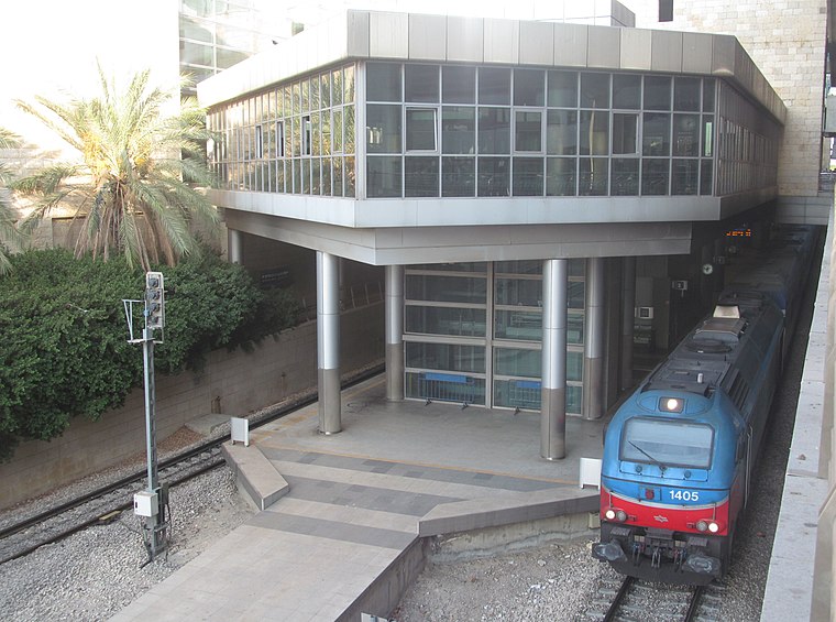
Photo: My another account, CC0.
Ben Gurion Airport railway station is an Israel Railways station located in the lower level of Ben Gurion International Airport's Terminal 3. The station opened on 10 October 2004, together with the opening of Terminal 3. Ben Gurion Airport is situated 3½ km southwest of Ha’Atsma’ut Road/Weizmann.
Babylon Jewish Heritage Museum
Museum
 Babylonian Jewry Heritage Center is a museum and research center in Or Yehuda, Israel. Babylon Jewish Heritage Museum is situated 3½ km west of Ha’Atsma’ut Road/Weizmann.
Places in the Area
Nearby places include Yehud-Monosson and Neve Monosson.
Yehud-Monosson
Town

Photo: Avi1111, Public domain.
Yehud-Monosson is a city formed by the joint municipality of the town of Yehud and the neighboring communal settlement of Neve Monosson in central Israel. In 2023 the city had a population of 32,071.
Neve Monosson
Suburb
Neve Monosson, also known as Neve Efraim and Neve Efraim Monosson, commonly called Monosson by its residents, is a municipal borough within the joint municipality of Yehud-Monosson in central Israel.
Ganay Yehuda
Village
Ganei Yehuda was a moshav founded in 1950 in the Ono Valley, adjacent to the cities of Yehud and Kiryat Ono. It was named after the biblical figure Judah whom was the fourth son of Jacob and Leah and the founder of the Israelite Tribe of Judah.
Ha’Atsma’ut Road/Weizmann
- Type: Bus stop
- Category: transportation
- Location: Central District, Israel, Middle East, Asia
- View on OpenStreetMap
Latitude
32.02824° or 32° 1′ 42″ northLongitude
34.89107° or 34° 53′ 28″ eastOpen location code
8G4P2VHR+7COpenStreetMap ID
node 1803009949OpenStreetMap feature
highway=bus_stopOpenStreetMap feature
public_transport=platform
This page is based on OpenStreetMap, Wikidata, and Wikimedia Commons.
We’d love your help improving our open data sources. Thank you for contributing.
Satellite Map
Discover Ha’Atsma’ut Road/Weizmann from above in high-definition satellite imagery.
In Other Languages
From Arabic to Hebrew—“Ha’Atsma’ut Road/Weizmann” goes by many names.
- Arabic: “طريق هعتسمؤوت/ڤايتسمان”
- Hebrew: “דרך העצמאות / וייצמן”
Notable Places Nearby
Highlights include Yahood Town Hall and Al-‘Abbasiyya Mosque.
Nearby Places
Explore places such as Bank Leumi and Domino’s.
Israel: Must-Visit Destinations
Delve into Tel Aviv, Carmel Range, Haifa, and Nazareth.
Curious Bus Stops to Discover
Uncover intriguing bus stops from every corner of the globe.
About Mapcarta. Data © OpenStreetMap contributors and available under the Open Database License". Text is available under the CC BY-SA 4.0 license, except for photos, directions, and the map. Photo: Bienchido, CC BY-SA 3.0.