Ha’Ilanot/Eilat
Ha’Ilanot/Eilat is a bus stop in Central District, Israel. Ha’Ilanot/Eilat is situated nearby to the village Kfar Maas, as well as near the hospital Beit Rivka.| Tap on a place to explore it |
Places of Interest Nearby
Highlights include Rabin Medical Center – Beilinson Campus and Great Synagogue.
Rabin Medical Center – Beilinson Campus
Hospital
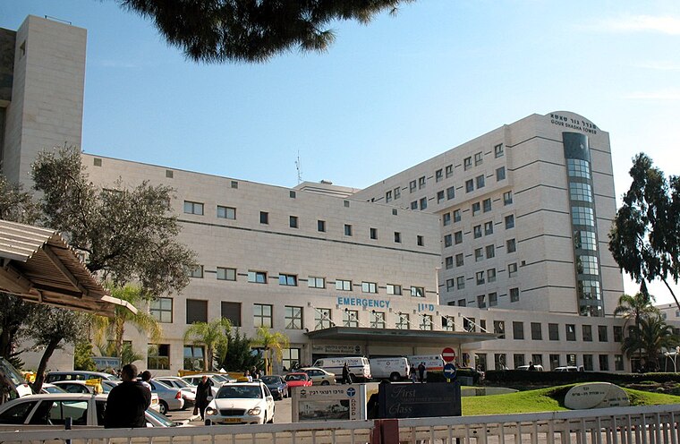
Photo: Wikimedia, Public domain.
Rabin Medical Center is a large general hospital located in Petah Tikva, Israel. It is owned and operated by Clalit Health Services, Israel's largest health maintenance organization. Rabin Medical Center – Beilinson Campus is situated 3½ km northwest of Ha’Ilanot/Eilat.
Great Synagogue

Photo: Gellerj, CC BY-SA 3.0.
The Great Synagogue of Petah Tikva is an Orthodox Jewish congregation and synagogue, located on Hovevei Zion Street, in the centre of Petah Tikva, in the Central District of Israel. Great Synagogue is situated 3 km north of Ha’Ilanot/Eilat.
Gan Hai in Petah Tikva
Zoo
 Gan Hai in Petah Tikva is a zoo, which is situated 3 km northwest of Ha’Ilanot/Eilat.
Places in the Area
Nearby places include Kfar Maas and Gat Rimon.
Kfar Maas
Village

Photo: Wikimedia, CC BY-SA 3.0.
Kfar Ma'as is a moshav in central Israel. Located to the south of Petah Tikva on the edge of the Ono Valley, it falls under the jurisdiction of Drom HaSharon Regional Council. In 2023 it had a population of 893.
Gat Rimon
Village
Gat Rimon is a moshav in central Israel. Located in the Ono Valley in the Sharon plain between Ganei Tikva and Petah Tikva, it falls under the jurisdiction of Drom HaSharon Regional Council. In 2023 it had a population of 258.
Ganei Tikva
Village

Photo: דוד שי, CC BY-SA 3.0.
Ganei Tikva is a town with "city council" status in Israel bordering Kiryat Ono to the west, Petah Tikva to the north, Gat Rimon to the east and Savyon to the south.
Ha’Ilanot/Eilat
- Type: Bus stop
- Category: transportation
- Location: Central District, Israel, Middle East, Asia
- View on OpenStreetMap
Latitude
32.06401° or 32° 3′ 50″ northLongitude
34.89279° or 34° 53′ 34″ eastOpen location code
8G4P3V7V+J4OpenStreetMap ID
node 1803013389OpenStreetMap feature
highway=bus_stopOpenStreetMap feature
public_transport=platform
This page is based on OpenStreetMap, Wikidata, and Wikimedia Commons.
We’d love your help improving our open data sources. Thank you for contributing.
Satellite Map
Discover Ha’Ilanot/Eilat from above in high-definition satellite imagery.
In Other Languages
From Arabic to Hebrew—“Ha’Ilanot/Eilat” goes by many names.
- Arabic: “هَئيلَنوت/أيليت”
- Hebrew: “האילנות/אילת”
Notable Places Nearby
Highlights include Beit Rivka and HaHamisha Terminal.
Nearby Places
Explore places such as Ha’Ilanot/HaShlosha and HaIlanot/HaRakefet.
Israel: Must-Visit Destinations
Delve into Tel Aviv, Carmel Range, Haifa, and Nazareth.
Curious Bus Stops to Discover
Uncover intriguing bus stops from every corner of the globe.
About Mapcarta. Data © OpenStreetMap contributors and available under the Open Database License". Text is available under the CC BY-SA 4.0 license, except for photos, directions, and the map. Photo: Bienchido, CC BY-SA 3.0.