Porta Metronia
Porta Metronia is a railway stop in Municipio Roma VII, Rome, Lazio. Porta Metronia is situated nearby to Piazzale Ipponio, as well as near the sports venue A.S.D. Tennis Roma.| Tap on a place to explore it |
Places of Interest Nearby
Highlights include Caelian Hill and Porta Metronia.
Caelian Hill
Peak

Photo: Roundtheworld, CC BY 3.0.
The Caelian Hill is one of the famous seven hills of Rome.
Porta Metronia
City gate
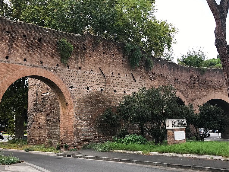
Photo: Gustavo La Pizza, CC BY-SA 4.0.
Porta Metronia is a gate in the third-century Aurelian Walls of Rome, Italy. The gate is located in the southern section of the wall between Porta San Giovanni to the east and Porta Latina to the south. Porta Metronia is situated 310 metres west of Porta Metronia.
Lateran Obelisk
Obelisk

Photo: Wikimedia, CC BY-SA 3.0.
The Lateran Obelisk is the largest standing ancient Egyptian obelisk in the world, and it is also the tallest obelisk in Italy. It originally weighed 413 tonnes, but after collapsing and being re-erected 4 metres shorter, now weighs around 300 tonnes. Lateran Obelisk is situated 500 metres northeast of Porta Metronia.
Places in the Area
Nearby places include Colosseo and Palatine Hill.
Colosseo

Photo: Paolostefano1412, CC BY-SA 3.0.
The Colosseo district is the heart of ancient Rome and the Roman Empire. It has the Colosseum, the Forum, and the Capitoline Museum.
Palatine Hill
Locality

Photo: Lil Herodotus, CC BY-SA 4.0.
The Palatine Hill, which relative to the seven hills of Rome is the centremost, is one of the most ancient parts of the city; it has been called "the first nucleus of the Roman Empire".
Esquilino-San Giovanni

Photo: Cristian Bortes, CC BY 2.0.
Esquilino and San Giovanni are adjacent neighborhoods in Rome. Esquilino is named for the Esquiline hill on which it stands. It lies south of the Termini station and is centred more or less on the Piazza Vittorio Emmanuele II.
Porta Metronia
- Type: Railway stop
- Categories: transport stop and transportation
- Location: Municipio Roma VII, Rome, Metropolitan Rome, Lazio, Central Italy, Italy, Europe
- View on OpenStreetMap
Latitude
41.88272° or 41° 52′ 58″ northLongitude
12.50229° or 12° 30′ 8″ eastOperator
ATACNetwork
Metro COpen location code
8FHJVGM2+3WOpenStreetMap ID
node 2111420461OpenStreetMap feature
public_transport=stop_position
This page is based on OpenStreetMap, Wikidata, and Wikimedia Commons.
We’d love your help improving our open data sources. Thank you for contributing.
Satellite Map
Discover Porta Metronia from above in high-definition satellite imagery.
Places with the Same Name
Discover other places named “Porta Metronia”.
Notable Places Nearby
Highlights include Piazzale Ipponio and A.S.D. Tennis Roma.
Nearby Places
Explore places such as Porta Metronia and Castoro.
Rome: Must-Visit Destinations
Delve into North Centre, Modern Centre, Old Rome, and Vatican.
Curious Railway Stops to Discover
Uncover intriguing railway stops from every corner of the globe.
About Mapcarta. Data © OpenStreetMap contributors and available under the Open Database License". Text is available under the CC BY-SA 4.0 license, except for photos, directions, and the map. Photo: Absent-08, CC BY-SA 4.0.