Servizio Ausili AUSL Valle d’Aosta
Servizio Ausili AUSL Valle d’Aosta is a hospital in Aosta, Aosta Valley which is located on loc. Grand Chemin. Servizio Ausili AUSL Valle d’Aosta is situated nearby to the public building Ministero dei Trasporti Ufficio Motorizzazione Civile, as well as near Regione Autonoma della Valle d’Aosta - Dipartimento Politiche del Lavoro e Formazione - Assessorato Territorio e Ambiente.| Tap on a place to explore it |
- Type: Hospital
- Address: loc. Grand Chemin 22, Saint Christophe, 11020
- Wheelchair access: yes
Places of Interest Nearby
Highlights include Aosta Airport and Passerin d’Entrèves Castle.
Aosta Airport
Aerodrome
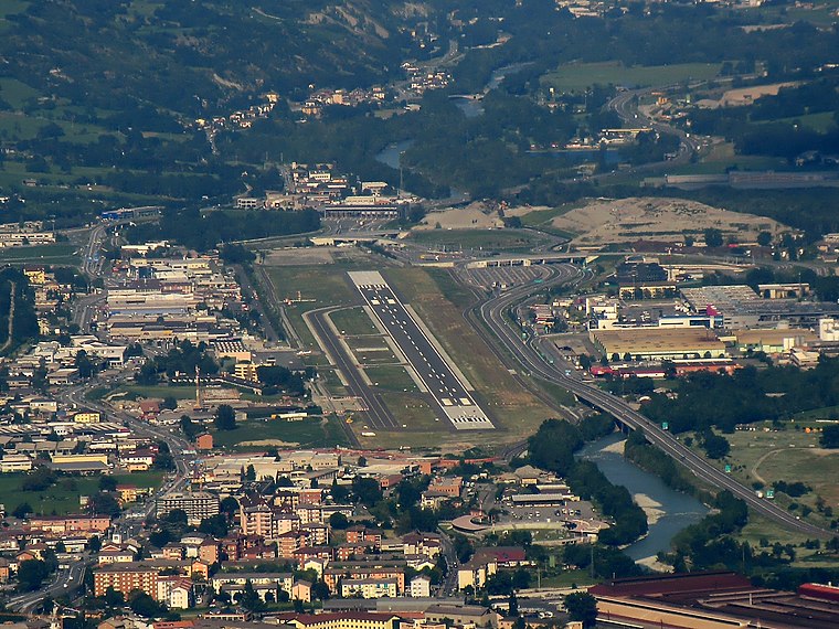
Photo: Luigi.tuby, CC BY-SA 3.0.
Aosta Valley Airport is an airport located in Les Îles, Saint-Christophe, serving the Aosta Valley region of Italy. Air Vallée previously had its head office on the property of Aosta Airport.
Passerin d’Entrèves Castle
Castle

Photo: Patafisik, CC BY-SA 3.0.
Passerin d’Entrèves Castle is situated 1¼ km north of Servizio Ausili AUSL Valle d’Aosta.
Town hall of Saint-Christophe
Town hall

Photo: Patafisik, CC BY-SA 3.0.
Town hall of Saint-Christophe is situated 1¼ km northeast of Servizio Ausili AUSL Valle d’Aosta.
Places in the Area
Nearby places include Cache and Excenex.
Cache
Hamlet
Cache is a frazione of the city of Aosta, in the Aosta Valley region of Italy. Cache is situated 3½ km northwest of Servizio Ausili AUSL Valle d’Aosta.
Excenex
Hamlet

Photo: Patafisik, CC BY-SA 4.0.
Excenex is a hamlet, which is situated 4½ km northwest of Servizio Ausili AUSL Valle d’Aosta.
Oveillan
Hamlet

Photo: Patafisik, CC BY-SA 4.0.
Oveillan is a hamlet, which is situated 6 km west of Servizio Ausili AUSL Valle d’Aosta.
Servizio Ausili AUSL Valle d’Aosta
- Category: health care
- Location: Aosta, Aosta Valley, Northwest Italy, Italy, Europe
- View on OpenStreetMap
Latitude
45.73848° or 45° 44′ 19″ northLongitude
7.35156° or 7° 21′ 6″ eastOpen location code
8FQ9P9Q2+9JOpenStreetMap ID
node 2349121564OpenStreetMap feature
amenity=hospitalOpenStreetMap feature
healthcare=hospitalOpenStreetMap attribute
wheelchair=yes
This page is based on OpenStreetMap, Wikidata, and Wikimedia Commons.
We’d love your help improving our open data sources. Thank you for contributing.
Satellite Map
Discover Servizio Ausili AUSL Valle d’Aosta from above in high-definition satellite imagery.
Notable Places Nearby
Highlights include Ministero dei Trasporti Ufficio Motorizzazione Civile and Regione Autonoma della Valle d’Aosta - Dipartimento Politiche del Lavoro e Formazione - Assessorato Territorio e Ambiente.
Nearby Places
Explore places such as Agricenter and Federazione Volontari del Soccorso della Valle d’Aosta.
Curious Places to Discover
Uncover intriguing places from every corner of the globe.
About Mapcarta. Data © OpenStreetMap contributors and available under the Open Database License". Text is available under the CC BY-SA 4.0 license, except for photos, directions, and the map. Photo: Wikimedia, CC0.