Botanic Gardens Station
Botanic Gardens Station is a taxicab stand in Singapore. Botanic Gardens Station is situated nearby to the government office Embassy of France, as well as near the tourism office Bukit Timah Visitor Services Counter.| Tap on a place to explore it |
Places of Interest Nearby
Highlights include Singapore Botanic Gardens and Botanic Gardens.
Singapore Botanic Gardens
Park

Photo: Wikimedia, CC BY-SA 3.0.
The Singapore Botanic Gardens is a 166-year-old tropical garden located at the fringe of the Orchard Road shopping district in Singapore. It is one of three gardens, and the only tropical garden, to be honoured as a UNESCO World Heritage Site.
Botanic Gardens
Metro station

Photo: ZKang123, CC BY-SA 4.0.
Botanic Gardens MRT station is an underground Mass Rapid Transit interchange station on the Circle Line and the Downtown Line. Situated in Tanglin, Singapore, the station is located northwest of the Singapore Botanic Gardens at the junction of Bukit Timah Road and Cluny Park Road. Botanic Gardens is situated 150 metres northeast of Botanic Gardens Station.
Atbara House
Public building
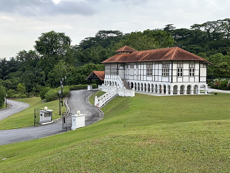
Photo: Fuzheado, CC BY-SA 3.0.
Atbara House is an historic house on Gallop Road in the Singapore Botanic Gardens. It is often regarded as the first Black and White House in Singapore, despite it not actually being a black and white house. Atbara House is situated 1 km southwest of Botanic Gardens Station.
Places in the Area
Nearby places include Tanglin and Holland Village.
Tanglin
Suburb
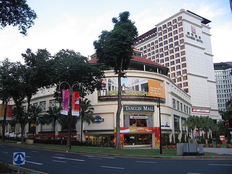
Photo: Sengkang, Copyrighted free use.
Tanglin is a planning area located within the Central Region of Singapore. Tanglin is located west of Newton, Orchard, River Valley and Singapore River, south of Novena, east of Bukit Timah, northeast of Queenstown and north of Bukit Merah.
Holland Village
Suburb

Photo: Takamaxa, Copyrighted free use.
Holland Village, often abbreviated as Holland V, is a neighbourhood located along the boundary between the planning areas of Bukit Timah and Queenstown in the Central Region of Singapore.
Novena
Suburb
Novena is a planning area located within the Central Region of Singapore. Novena is bounded by Toa Payoh to the north, Bukit Timah to the west, Tanglin to the south and Kallang to the east. Novena is situated 2½ km east of Botanic Gardens Station.
Botanic Gardens Station
- Type: Taxicab stand
- Category: transportation
- Location: Singapore, Southeast Asia, Asia
- View on OpenStreetMap
Latitude
1.32151° or 1° 19′ 17″ northLongitude
103.81446° or 103° 48′ 52″ eastOpen location code
6PH58RC7+JQOpenStreetMap ID
node 3800199440OpenStreetMap feature
amenity=taxi
This page is based on OpenStreetMap, Wikidata, and Wikimedia Commons.
We’d love your help improving our open data sources. Thank you for contributing.
Satellite Map
Discover Botanic Gardens Station from above in high-definition satellite imagery.
In Other Languages
“Botanic Gardens Station” goes by many names.
- Chinese: “植物园地铁站”
Places with the Same Name
Discover other places named “Botanic Gardens Station”.
Notable Places Nearby
Highlights include Embassy of France and Embassy of France in Singapore.
Nearby Places
Explore places such as Cluny Park Residence and The Ice Cream Man and Friends.
Singapore: Must-Visit Destinations
Delve into Singapore Changi Airport, Sentosa and Harbourfront, North and West, and Riverside.
Curious Taxicab Stands to Discover
Uncover intriguing taxicab stands from every corner of the globe.
About Mapcarta. Data © OpenStreetMap contributors and available under the Open Database License". Text is available under the CC BY-SA 4.0 license, except for photos, directions, and the map. Photo: Khairul Nizam, CC BY 2.0.