Le Pointier
Le Pointier is a hamlet in Charvensod, Aosta Valley. Le Pointier is situated nearby to the hamlet Reverier-Dessus, as well as near Reverier-Dessous.| Tap on a place to explore it |
Places of Interest
Highlights include Aosta Airport and Aosta/Aoste railway station.
Aosta Airport
Aerodrome
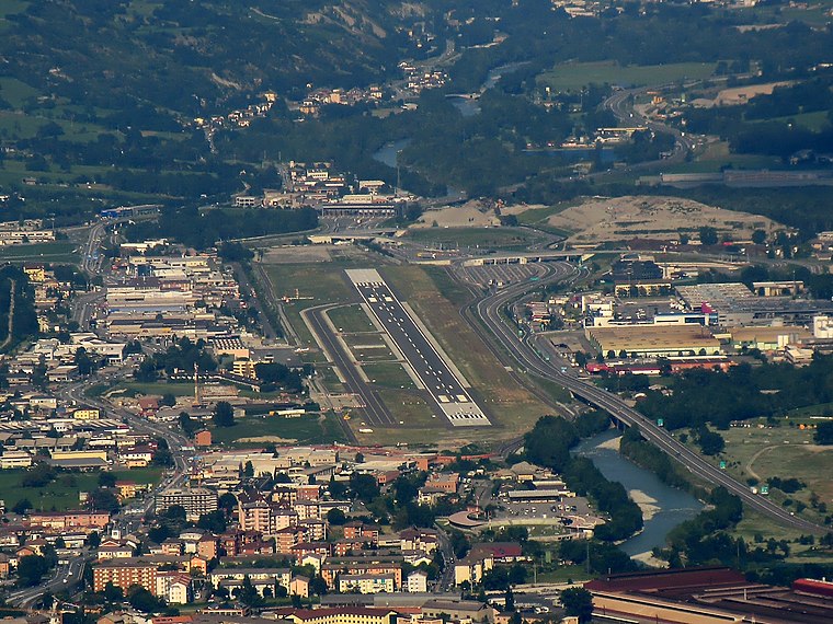
Photo: Luigi.tuby, CC BY-SA 3.0.
Aosta Valley Airport is an airport located in Les Îles, Saint-Christophe, serving the Aosta Valley region of Italy. Air Vallée previously had its head office on the property of Aosta Airport. Aosta Airport is situated 3 km northeast of Le Pointier.
Aosta/Aoste railway station
Railway station

Photo: Tenam2, CC BY-SA 3.0.
Aosta/Aoste railway station is the main station serving the city and comune of Aosta, in the autonomous region of Aosta Valley, northwestern Italy. Opened in 1886, it forms part of the Chivasso–Ivrea–Aosta railway, and is also a junction station for a branch line to Pré-Saint-Didier, in the Valdigne, on the way towards Courmayeur. Aosta/Aoste railway station is situated 2½ km northwest of Le Pointier.
Émile Chanoux square
Square

Photo: Luca Aless, CC BY-SA 3.0.
Émile Chanoux square is a city square in Aosta, Italy. Émile Chanoux square is situated 3 km northwest of Le Pointier.
Places in the Area
Nearby places include Aosta and Pila.
Aosta
 Aosta is the capital of Italian autonomous region of Aosta Valley. The town is in a small valley with houses going up the slopes of the surrounding mountains.
Pila
Village

Photo: Kulmalukko, CC BY-SA 3.0.
Pila is an Alpine ski-resort in the Aosta Valley region of northern Italy. It is a frazione of the comune of Gressan. There are more than 24 pistes, including 4 blue runs, 29 red runs and 4 black runs, with a pipe zone and a slopestyle zone. Pila is situated 4½ km southwest of Le Pointier.
Cache
Hamlet
Cache is a frazione of the city of Aosta, in the Aosta Valley region of Italy. Cache is situated 5 km north of Le Pointier.
Le Pointier
- Type: Hamlet
- Category: locality
- Location: Charvensod, Aosta Valley, Northwest Italy, Italy, Europe
- View on OpenStreetMap
Latitude
45.71825° or 45° 43′ 6″ northLongitude
7.34746° or 7° 20′ 51″ eastOpen location code
8FQ9P89W+7XOpenStreetMap ID
node 5024366617OpenStreetMap feature
place=hamlet
This page is based on OpenStreetMap, Wikidata, and Wikimedia Commons.
We’d love your help improving our open data sources. Thank you for contributing.
Satellite Map
Discover Le Pointier from above in high-definition satellite imagery.
Places with the Same Name
Discover other places named “Le Pointier”.
Localities in the Area
Explore places such as Reverier-Dessus and Reverier.
Notable Places Nearby
Highlights include Municipio di Pollein and Poste di Pollein.
Aosta Valley: Must-Visit Destinations
Delve into Aosta, Courmayeur, and La Thuile.
Curious Hamlets to Discover
Uncover intriguing hamlets from every corner of the globe.
About Mapcarta. Data © OpenStreetMap contributors and available under the Open Database License". Text is available under the CC BY-SA 4.0 license, except for photos, directions, and the map. Photo: Cruccone, CC BY 3.0.