Tangenheia
Tangenheia is a quarter in Kragerø, Telemark, Innlandet. Tangenheia is situated nearby to the locality Stilnestangen, as well as near the quarter Bråten.| Tap on a place to explore it |
Places of Interest
Highlights include Kragerø Church and Kragerø Station.
Kragerø Church
Church
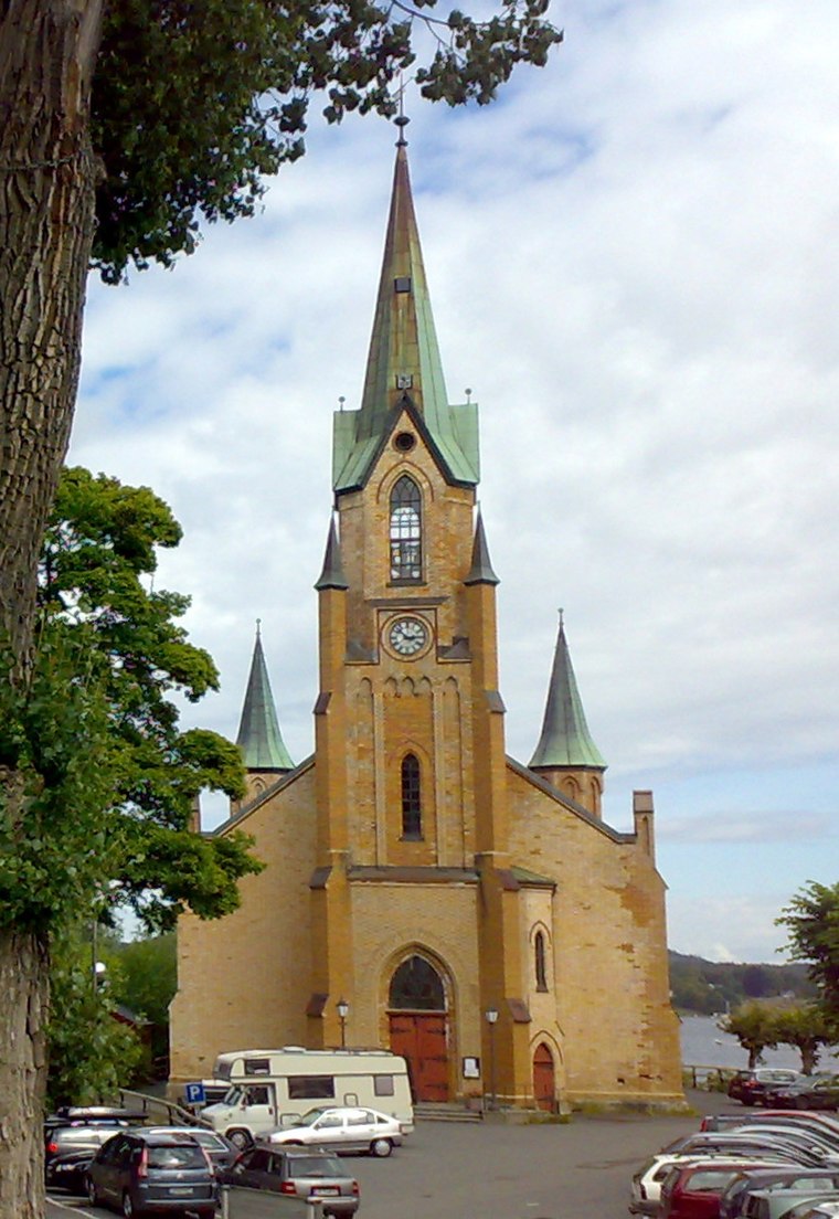
Photo: Bjoertvedt, CC BY-SA 3.0 no.
Kragerø Church is a parish church of the Church of Norway in Kragerø Municipality in Telemark county, Norway. It is located in the town of Kragerø. It is the church for the Kragerø parish which is part of the Bamble prosti in the Diocese of Agder og Telemark.
Kragerø Station
Office building

Photo: Anders Beer Wilse, Public domain.
Kragerø Station was a railway station located in Kragerø, Norway on the Kragerø Line.
Tåtøy
Island
Tåtøy or Tåtei is an island in Kragerø Municipality in Telemark county, Norway. The 1-square-kilometre island is located in the Kilsfjord, just to the south of the mainland town of Kragerø. Tåtøy is situated 2½ km southwest of Tangenheia.
Tangenheia
- Type: Quarter
- Category: locality
- Location: Kragerø, Telemark, East Norway, Alvdal, Innlandet, Norway, Nordic countries, Europe
- View on OpenStreetMap
Latitude
58.87421° or 58° 52′ 27″ northLongitude
9.41296° or 9° 24′ 47″ eastOpen location code
9FCFVCF7+M5OpenStreetMap ID
node 5678171936OpenStreetMap feature
place=quarter
This page is based on OpenStreetMap, Wikidata, and Wikimedia Commons.
We’d love your help improving our open data sources. Thank you for contributing.
Satellite Map
Discover Tangenheia from above in high-definition satellite imagery.
Places with the Same Name
Discover other places named “Tangenheia”.
Localities in the Area
Explore places such as Stilnestangen and Bråten.
Notable Places Nearby
Highlights include Kragerø politistasjon and Telemark fengsel, Kragerø avdeling.
Telemark: Must-Visit Destinations
Delve into Skien, Porsgrunn, Notodden, and Rjukan.
Curious Quarters to Discover
Uncover intriguing quarters from every corner of the globe.
About Mapcarta. Data © OpenStreetMap contributors and available under the Open Database License". Text is available under the CC BY-SA 4.0 license, except for photos, directions, and the map. Photo: Wikimedia, CC BY-SA 3.0.