Pasvikveien
Pasvikveien is a bus stop in Sør-Varanger Municipality, Finnmark. Pasvikveien is situated nearby to the pitch Kirkenes stadion, as well as near the swimming pool Barentsbadet.| Tap on a place to explore it |
Places of Interest Nearby
Highlights include Kirkenes Church.
Kirkenes Church
Church
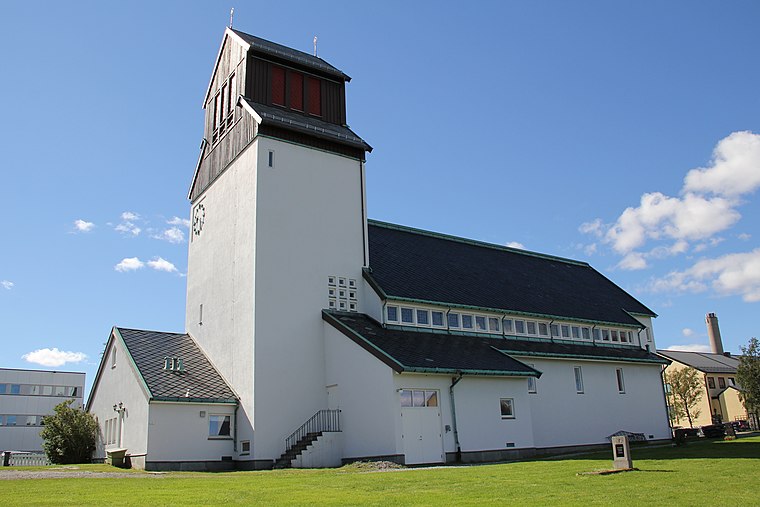
Photo: Htm, CC BY-SA 3.0.
Kirkenes Church is a parish church of the Church of Norway in Sør-Varanger Municipality in Finnmark county, Norway. It is located in the town of Kirkenes, just off the European route E06 highway. Kirkenes Church is situated 530 metres northwest of Pasvikveien.
Places in the Area
Nearby places include Kirkenes and Hesseng.
Kirkenes
 Kirkenes is a town in the Finnmark region of Norway, far east near the Russian border, more or less in the end of mainland Norway. This is the last port for Hurtigruten and the end of Norway's main road E6, 2,500 km from Oslo and 3,120 km from Trelleborg.
Hesseng
Village
Hesseng is a village in Sør-Varanger Municipality in Finnmark county, Norway. The village lies about 5 kilometres south of the town of Kirkenes. The village of Hesseng lies at the intersection of the European route E105 and European route E6 highways. Hesseng is situated 4½ km southwest of Pasvikveien.
Bjørnevatn
Village
 Bjørnevatn, Kuõbǯǯjäuʹrr, Guovžajávri, or Kruuvakylä is a village in Sør-Varanger Municipality in Finnmark county, Norway. The village lies about 8 kilometres south of the town of Kirkenes and about 3.8 kilometres west of the Norway-Russia border. Bjørnevatn is situated 7 km south of Pasvikveien.
Pasvikveien
- Type: Bus stop
- Category: transportation
- Location: Sør-Varanger Municipality, Finnmark, Northern Norway, Norway, Nordic countries, Europe
- View on OpenStreetMap
Latitude
69.72411° or 69° 43′ 27″ northLongitude
30.05078° or 30° 3′ 3″ eastOpen location code
9GXGP3F2+J8OpenStreetMap ID
node 6372262448OpenStreetMap feature
highway=bus_stop
This page is based on OpenStreetMap, Wikidata, and Wikimedia Commons.
We’d love your help improving our open data sources. Thank you for contributing.
Satellite Map
Discover Pasvikveien from above in high-definition satellite imagery.
Notable Places Nearby
Highlights include Kirkenes stadion and Barentsbadet.
Nearby Places
Explore places such as Pasvikveien and MusikkGarasjen.
Finnmark: Must-Visit Destinations
Delve into Vadsø, Nordkapp, Kirkenes, and Alta.
Curious Bus Stops to Discover
Uncover intriguing bus stops from every corner of the globe.
About Mapcarta. Data © OpenStreetMap contributors and available under the Open Database License". Text is available under the CC BY-SA 4.0 license, except for photos, directions, and the map. Photo: AnWoTh, CC BY-SA 3.0.