Gavegrotten
Gavegrotten is a gift shop in Fredrikstad, Østfold, Innlandet. Gavegrotten is situated nearby to the sports venue Turnhallen Fredrikstad, as well as near the library Fredrikstad bibliotek.| Tap on a place to explore it |
Places of Interest Nearby
Highlights include Fredrikstad bibliotek and Fredrikstad Cathedral.

Fredrikstad Cathedral
Church
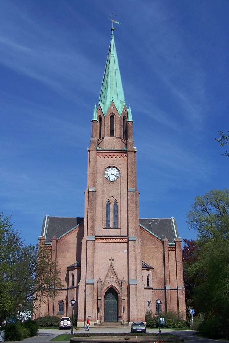
Photo: Cnyborg, CC BY-SA 3.0.
Fredrikstad Cathedral is a cathedral located in the west of the city of Fredrikstad in Østfold county, Norway. It is the episcopal seat of the Diocese of Borg of the Church of Norway. Fredrikstad Cathedral is situated 300 metres north of Gavegrotten.
Fredrikstad Station
Railway station

Photo: JohnM, Public domain.
Fredrikstad Station is a railway station located at the city of Fredrikstad in Norway on the Østfold Line. It is located about 200 meters from Fredrikstad Hospital. The station is served by regional trains between Oslo and Halden with hourly headway by Vy. Fredrikstad Station is situated 530 metres northeast of Gavegrotten.
Places in the Area
Nearby places include Cicignon and Gressvik.

Gressvik
Village
 Gressvik is a village located in the municipality of Fredrikstad, Norway. The river Seut separates Gressvik from the city of Fredrikstad. Gressvik stretches from Ørebekk in the north, to Rød and Viker in the south.
Borge
Hamlet

Photo: PerPlex, Public domain.
Borge is a parish and former municipality in Østfold county, Norway. Today it is located in the northeast part of Fredrikstad municipality, near the border with Sarpsborg. Borge is situated 7 km northeast of Gavegrotten.
Gavegrotten
- Type: Gift shop
- Category: shop
- Location: Fredrikstad, Østfold, East Norway, Alvdal, Innlandet, Norway, Nordic countries, Europe
- View on OpenStreetMap
Latitude
59.20688° or 59° 12′ 25″ northLongitude
10.94189° or 10° 56′ 31″ eastOpen location code
9FFG6W4R+QQOpenStreetMap ID
node 7179166849OpenStreetMap feature
shop=gift
This page is based on OpenStreetMap, Wikidata, and Wikimedia Commons.
We’d love your help improving our open data sources. Thank you for contributing.
Satellite Map
Discover Gavegrotten from above in high-definition satellite imagery.
Notable Places Nearby
Highlights include Turnhallen Fredrikstad and Bibliotekparken.
Nearby Places
Explore places such as Severin and Cicignon legekontor.
Østfold: Must-Visit Destinations
Delve into Sarpsborg, Moss, Halden, and Askim.
Curious Gift Shops to Discover
Uncover intriguing gift shops from every corner of the globe.
About Mapcarta. Data © OpenStreetMap contributors and available under the Open Database License". Text is available under the CC BY-SA 4.0 license, except for photos, directions, and the map. Photo: Thomasmh, CC BY-SA 3.0.