Monkrigg Mains
Monkrigg Mains is a locality in East Lothian, Scotland. Monkrigg Mains is situated nearby to the locality East Port, as well as near the hamlet Lennoxlove Acredales.| Tap on a place to explore it |
Places of Interest
Highlights include St Mary’s Collegiate Church and St Martin’s Church, Haddington.
St Mary’s Collegiate Church
Church
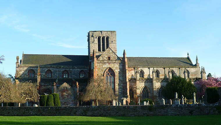
Photo: Kim Traynor, CC BY-SA 3.0.
The Collegiate Church of St Mary the Virgin is a Church of Scotland parish church in Haddington, East Lothian, Scotland. Building work on the church was started in 1380, and further building and rebuilding has taken place up to the present day.
St Martin’s Church, Haddington
Ruins
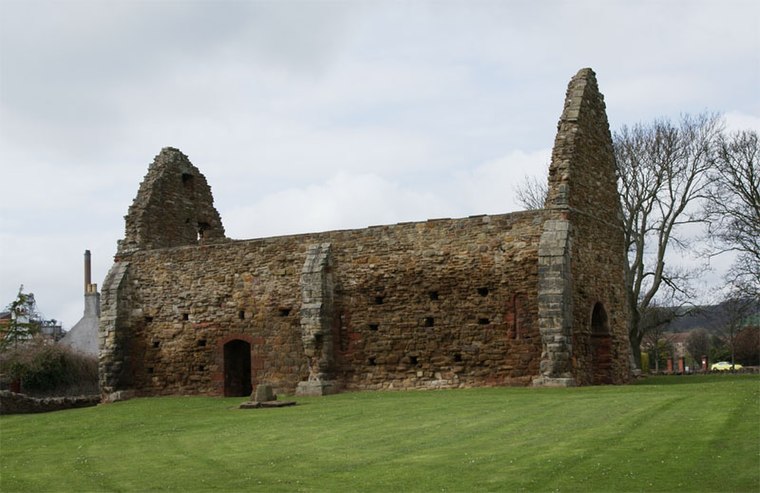
Photo: Otter, CC BY-SA 3.0.
St Martin's Church, Haddington is a ruined church in the town of Haddington, East Lothian, Scotland. A rare example of a 12th-century parish church, it was originally attached to the nunnery of St Mary's at Nungate.
Lennoxlove House
Building

Photo: Kevin Rae, CC BY-SA 2.0.
Lennoxlove House is a historic house set in woodlands half a mile south of Haddington in East Lothian, Scotland. The house comprises a 15th-century tower, originally known as Lethington Castle, and has been extended several times, principally in the 17th, 19th and 20th centuries.
Places in the Area
Nearby places include Haddington and Bolton.
Haddington

Photo: Achromatic, CC BY 3.0.
Haddington is a market town in East Lothian, 15 miles east of Edinburgh in central Scotland. It's the administrative centre of East Lothian council area, with a population of 10,360 in 2020.
Bolton
Hamlet

Photo: james denham, CC BY-SA 2.0.
Bolton is a hamlet and the third smallest parish in East Lothian, Scotland. It lies approximately 2 miles south of Haddington and 20 miles east of Edinburgh, and is an entirely agricultural parish, 6 miles long by about 1.25 miles wide. Bolton is situated 2 miles southwest of Monkrigg Mains.
Morham
Hamlet

Photo: james denham, CC BY-SA 2.0.
Morham, East Lothian, sometimes spelt Moram, Morum, or Morhame in old records, is the smallest parish in Scotland, sandwiched between five other parishes: Haddington, Garvald, Yester, Whittingehame, and Prestonkirk, in the undulating lower reaches of the Lammermuir Hills. Morham is situated 2 miles east of Monkrigg Mains.
Monkrigg Mains
- Type: Locality
- Location: East Lothian, Scotland, United Kingdom, Britain and Ireland, Europe
- View on OpenStreetMap
Latitude
55.94385° or 55° 56′ 38″ northLongitude
-2.76205° or 2° 45′ 43″ westOpen location code
9C7VW6VQ+G5OpenStreetMap ID
node 8135777766OpenStreetMap feature
place=locality
This page is based on OpenStreetMap, Wikidata, and Wikimedia Commons.
We’d love your help improving our open data sources. Thank you for contributing.
Satellite Map
Discover Monkrigg Mains from above in high-definition satellite imagery.
Localities in the Area
Explore places such as Monkrigg and East Port.
Notable Places Nearby
Highlights include Monkrigg and Crow Wood.
Scotland: Must-Visit Destinations
Delve into Edinburgh, Glasgow, Aberdeen, and Dundee.
Curious Localities to Discover
Uncover intriguing localities from every corner of the globe.
About Mapcarta. Data © OpenStreetMap contributors and available under the Open Database License". Text is available under the CC BY-SA 4.0 license, except for photos, directions, and the map. Photo: Ritchyblack, FAL.