Lafteråsen gravrøys
Lafteråsen gravrøys is an archaeological site in Kongsberg, Buskerud, Innlandet. Lafteråsen gravrøys is situated nearby to the playground Soners vei lekeplass, as well as near the recreation area Gamlegrendåsen Syd.| Tap on a place to explore it |
Places of Interest Nearby
Highlights include Labrofossen and Kongsberg Bridge.
Labrofossen
Waterfall
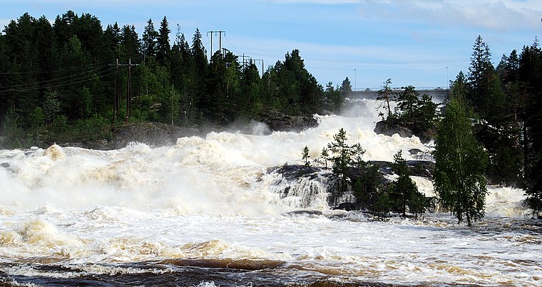
Photo: Mahlum, Public domain.
Labrofossen is a waterfall, which is situated 1½ km south of Lafteråsen gravrøys.
Kongsberg Bridge
Bridge

Photo: Bergenga, CC BY-SA 4.0.
Kongsberg Bridge is situated 2 km northwest of Lafteråsen gravrøys.
Gamlegrendåsen School
School

Photo: Thomas.bjorndahl, CC BY-SA 3.0.
Gamlegrendåsen School is situated 1½ km north of Lafteråsen gravrøys.
Places in the Area
Nearby places include Skollenborg.
Skollenborg
Hamlet

Photo: Wikimedia, CC BY-SA 3.0.
Skollenborg is a small village in Sandsvær in the municipality of Kongsberg in Buskerud county, Norway. Since 2015 Skollenborg has been a part of the Kongsberg urban area.
Lafteråsen gravrøys
- Type: Archaeological site
- Categories: historic site, tourist attraction, and tourism
- Location: Kongsberg, Buskerud, East Norway, Alvdal, Innlandet, Norway, Nordic countries, Europe
- View on OpenStreetMap
Latitude
59.63601° or 59° 38′ 10″ northLongitude
9.66859° or 9° 40′ 7″ eastOpen location code
9FFFJMP9+CCOpenStreetMap ID
node 8734510664OpenStreetMap feature
historic=archaeological_site
This page is based on OpenStreetMap, Wikidata, and Wikimedia Commons.
We’d love your help improving our open data sources. Thank you for contributing.
Satellite Map
Discover Lafteråsen gravrøys from above in high-definition satellite imagery.
Notable Places Nearby
Highlights include Soners vei lekeplass and Gamlegrendåsen Syd.
Nearby Places
Explore places such as Lafteråsen and Obs Bygg Kongsberg.
Buskerud: Must-Visit Destinations
Delve into Drammen, Hemsedal, Hallingdal, and Geilo.
Curious Archaeological Sites to Discover
Uncover intriguing archaeological sites from every corner of the globe.
About Mapcarta. Data © OpenStreetMap contributors and available under the Open Database License". Text is available under the CC BY-SA 4.0 license, except for photos, directions, and the map. Photo: Wikimedia, CC BY-SA 3.0.