Gorrie Terrace
Gorrie Terrace is a bus stop in Dundee City, Scotland. Gorrie Terrace is situated nearby to the suburb Balgowan, as well as near the playground Auchinblae Playpark.| Tap on a place to explore it |
Places of Interest Nearby
Highlights include Tannadice Park and Dens Park.
Tannadice Park
Stadium
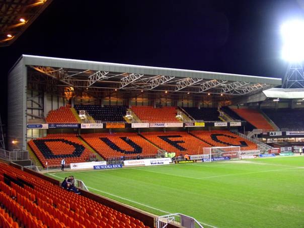
Photo: Wikimedia, CC BY-SA 3.0.
Tannadice Park, officially known as The CalForth Construction Arena for sponsorship reasons, is a football stadium in Dundee, Scotland. It is the home ground of Dundee United F.C., who have played at Tannadice since the club was founded as Dundee Hibernian in 1909. Tannadice Park is situated 2 miles southeast of Gorrie Terrace.
Dens Park
Stadium

Photo: Jmorrison230582, Public domain.
Dens Park is a football stadium in Dundee, Scotland, which is the home of Scottish Premiership club Dundee F.C. and has a capacity of 11,775. Tannadice Park, the home of rivals Dundee United, is just 200 yards away. Dens Park is situated 2 miles southeast of Gorrie Terrace.
Mains Castle

Photo: Wikimedia, CC BY-SA 3.0.
Mains Castle is a 16th-century castle in Dundee, Scotland. The castle consists of several buildings surrounding a courtyard, although several of the original western buildings no longer exist. Mains Castle is situated 2 miles southeast of Gorrie Terrace.
Places in the Area
Nearby places include Balgowan and Strathmartine.
Balgowan
Suburb
Balgowan is an area of Dundee, Scotland. The name derives from the Scottish Gaelic Baile Ghobhainn, meaning "blacksmith's stead".
Strathmartine
Village

Photo: Val Vannet, CC BY-SA 2.0.
Strathmartine is an area of Angus, Scotland. It is to the north of Dundee and the surrounding district is often referred to as "the Howe o Strathmartine".
St Marys
Suburb
St Mary's is in a residential area of Dundee located in the extreme northwest of the city, to the north of Ardler and west of Kirkton. It is also bounded on the west by Downfield Golf Club, to the northwest by Clatto Country Park and to the north by Craigowl View.
Gorrie Terrace
- Type: Bus stop
- Category: transportation
- Location: Dundee City, Scotland, United Kingdom, Britain and Ireland, Europe
- View on OpenStreetMap
Latitude
56.4992° or 56° 29′ 57″ northLongitude
-3.00628° or 3° 0′ 23″ westOpen location code
9C8RFXXV+MFOpenStreetMap ID
node 9772452778OpenStreetMap feature
highway=bus_stopOpenStreetMap feature
public_transport=platform
This page is based on OpenStreetMap, Wikidata, and Wikimedia Commons.
We’d love your help improving our open data sources. Thank you for contributing.
Satellite Map
Discover Gorrie Terrace from above in high-definition satellite imagery.
Notable Places Nearby
Highlights include Auchinblae Playpark and St. Mary’s Community Church.
Nearby Places
Explore places such as Sidlaw Avenue and St Martins Avenue.
Scotland: Must-Visit Destinations
Delve into Edinburgh, Glasgow, Aberdeen, and Dundee.
Curious Bus Stops to Discover
Uncover intriguing bus stops from every corner of the globe.
About Mapcarta. Data © OpenStreetMap contributors and available under the Open Database License". Text is available under the CC BY-SA 4.0 license, except for photos, directions, and the map. Photo: Ritchyblack, FAL.