Twin Peaks-Lake Merced
Southwestern San Francisco is made up of several hilly neighborhoods that include some of the city's highest peaks, beautiful parkland, and tranquil neighborhoods tucked in the hillsides, where you'll find spectacular views and quiet parks.| Tap on a place to explore it |
Photo: Dschwen, CC BY-SA 3.0.
Places of Interest
Highlights include Mount Sutro and Forest Hill station.
Mount Sutro
Peak

Photo: Hourann Bosci, CC BY-SA 2.0.
Mount Sutro is a hill in central San Francisco, California. It was originally named Mount Parnassus.
Forest Hill station
Railway station

Photo: Pi.1415926535, CC BY-SA 3.0.
Forest Hill station is a Muni Metro station located near the Forest Hill and Laguna Honda neighborhoods on the West Side of San Francisco, California. It was originally built in 1916 to 1918 as part of the Twin Peaks Tunnel, and is the oldest subway station west of Philadelphia and east of Istanbul.
Laguna Honda Hospital and Rehabilitation Center
Hospital

Photo: Pi.1415926535, CC BY-SA 4.0.
Laguna Honda Hospital and Rehabilitation Center is a nonprofit, publicly funded, 780 bed long-term acute care hospital in San Francisco, California, United States.
Places in the Area
Nearby places include Castro-Noe Valley and Haight.
Castro-Noe Valley

Photo: brian kusler, CC BY 2.0.
The colorful Castro is the famous gay center of San Francisco, a vibrant and historic neighborhood full of businesses geared towards the city's LGBT community.
Haight

Photo: Dschwen, CC BY-SA 2.5.
The Haight is a district of San Francisco running along Haight Street and the famous center of San Francisco's hippie community, with a multitude of eclectic stores, coffee shops, and art that reflects this fact.
Noe Valley
Quarter
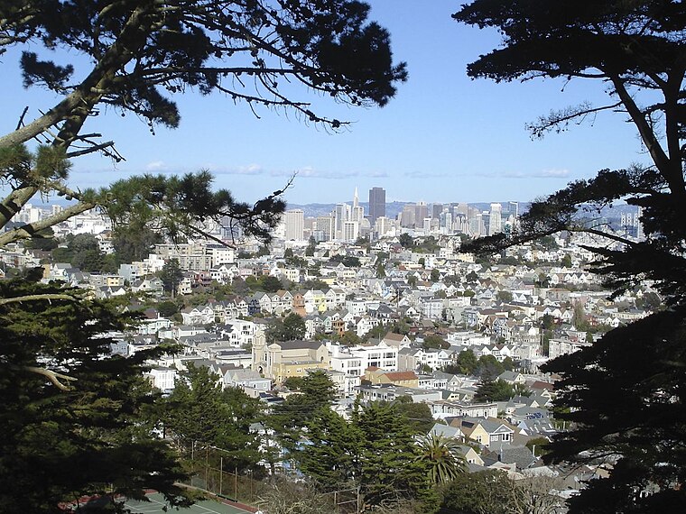
Photo: Yaman32, CC BY-SA 3.0.
Noe Valley is a neighborhood in the central part of San Francisco, California. It is named for Don José de Jesús Noé, noted 19th-century Californio statesman and ranchero, who owned much of the area and served as mayor.
Twin Peaks-Lake Merced
- Type: human settlement
- Description: settlement in San Francisco
- Location: San Francisco, Bay Area, California, United States, North America
- View on OpenStreetMap
Latitude
37.75206° or 37° 45′ 7″ northLongitude
-122.45396° or 122° 27′ 14″ westOpen location code
849VQG2W+RCWikidata ID
Q14219513
This page is based on Wikidata, Wikimedia Commons, and Wikivoyage.
We’d love your help improving our open data sources. Thank you for contributing.
Satellite Map
Discover Twin Peaks-Lake Merced from above in high-definition satellite imagery.
In Other Languages
From German to Hebrew—“Twin Peaks-Lake Merced” goes by many names.
- German: “San Francisco/Southwest”
- German: “Twin Peaks”
- Hebrew: “סן פרנסיסקו/טווין פיקס-לייק מרסד”
Localities in the Area
Explore places such as Midtown Terrace and Forest Knolls.
San Francisco: Must-Visit Destinations
Delve into Golden Gate, Chinatown-North Beach, Civic Center-Tenderloin, and Fisherman’s Wharf.
Explore These Curated Destinations
Discover places selected for their distinct character and enduring appeal.
About Mapcarta. Text is available under the CC BY-SA 4.0 license, except for photos, directions, and the map. Description text is based on the Wikivoyage page “Twin Peaks-Lake Merced”. Photo: Dschwen, CC BY-SA 3.0.