Steensheim
Steensheim is a nursing home in Hol, Buskerud, Innlandet. Steensheim is situated nearby to the nature reserve Branden, as well as near the village Hol.| Tap on a place to explore it |
Places of Interest Nearby
Highlights include Hol old Church and Hol Church.
Hol old Church
Church
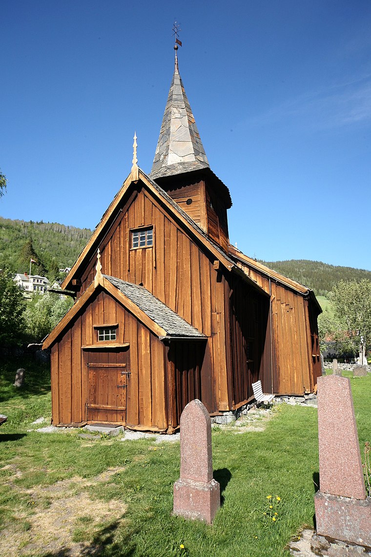
Photo: Wikimedia, CC BY-SA 3.0.
Hol old Church is situated 1¼ km northwest of Steensheim.

Hol II power station
Power station

Photo: PeltonMan, CC BY-SA 3.0.
Hol II power station is situated 3 km west of Steensheim.
Places in the Area
Nearby places include Hol and Hagafoss.
Hagafoss
Quarter
Hagafoss is a small village in Hol municipality in Buskerud, Norway. Hagafoss is located in upper Hallingdal where the road branches off towards Aurland along Norwegian county road 50.
Geilo

Photo: Wikimedia, CC BY-SA 2.0.
Geilo is a small town and ski resort in upper Hallingdal at the edge of Hardangervidda. It is convenient stop on the road or rail between Oslo and Bergen.
Steensheim
- Type: Nursing home
- Categories: building, public building, and health care
- Location: Hol, Buskerud, East Norway, Alvdal, Innlandet, Norway, Nordic countries, Europe
- View on OpenStreetMap
Latitude
60.60599° or 60° 36′ 22″ northLongitude
8.3164° or 8° 18′ 59″ eastOpen location code
9FGCJ848+9HOpenStreetMap ID
way 1003692224OpenStreetMap feature
amenity=nursing_homeOpenStreetMap feature
building=civic
This page is based on OpenStreetMap, Wikidata, and Wikimedia Commons.
We’d love your help improving our open data sources. Thank you for contributing.
Satellite Map
Discover Steensheim from above in high-definition satellite imagery.
Notable Places Nearby
Highlights include Hol kommunehus and Branden.
Nearby Places
Explore places such as Vestvang and Seimsbrua.
Buskerud: Must-Visit Destinations
Delve into Drammen, Kongsberg, Hemsedal, and Hallingdal.
Curious Nursing Homes to Discover
Uncover intriguing nursing homes from every corner of the globe.
About Mapcarta. Data © OpenStreetMap contributors and available under the Open Database License". Text is available under the CC BY-SA 4.0 license, except for photos, directions, and the map. Photo: TormodF, CC BY-SA 3.0.