Penhellis House
Penhellis House is a social service facility in Helston, West Cornwall, England. Penhellis House is situated nearby to Church of St Michael, as well as near the church Kingdom Hall.| Tap on a place to explore it |
Places of Interest Nearby
Highlights include Church of St Michael and Helston Library.
Church of St Michael
Church

Photo: Dr Neil Clifton, CC BY-SA 2.0.
Church of St Michael is situated 580 feet northeast of Penhellis House.
Helston Library
Library

Photo: Libraries Taskforce, CC BY 2.0.
Helston Library is situated 1,800 feet east of Penhellis House.
The Blue Anchor Inn
Pub
 The Blue Anchor Inn is a pub, which is situated 820 feet southeast of Penhellis House.
Places in the Area
Nearby places include Gwavas and Sithney.
Gwavas
Hamlet
Gwavas is a hamlet in the parish of Sithney, Cornwall, United Kingdom. Gwavas is adjoining Lowertown-by-Helston. The hamlet is a rural farming hamlet which once had a shop.
Sithney
Village
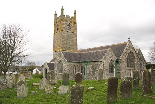
Photo: Tony Atkin, CC BY-SA 2.0.
Sithney is a village and civil parish in the West of Cornwall, England, United Kingdom. Sithney is north of Porthleven. The population including Boscadjack and Crowntown at the 2011 census was 841. Sithney is situated 1½ miles northwest of Penhellis House.
Trewennack
Hamlet

Photo: Jonathan Billinger, CC BY-SA 2.0.
Trewennack is a village northeast of Helston in Cornwall, England, United Kingdom. It is on the A394 main road. The name of the village comes from the Cornish language words tre, meaning 'farm' or 'settlement', and Gwedhenek, a personal name. Trewennack is situated 1½ miles northeast of Penhellis House.
Penhellis House
- Type: Social service facility
- Category: building
- Location: Helston, West Cornwall, Cornwall, West Country, England, United Kingdom, Britain and Ireland, Europe
- View on OpenStreetMap
Latitude
50.10239° or 50° 6′ 9″ northLongitude
-5.27849° or 5° 16′ 43″ westOpen location code
9C2P4P2C+XJOpenStreetMap ID
way 1041170648OpenStreetMap feature
amenity=social_facilityOpenStreetMap feature
building=yes
This page is based on OpenStreetMap, Wikidata, and Wikimedia Commons.
We’d love your help improving our open data sources. Thank you for contributing.
Satellite Map
Discover Penhellis House from above in high-definition satellite imagery.
Notable Places Nearby
Highlights include Kingdom Hall and Helston Bowling Club.
Nearby Places
Explore places such as Masonic Lodge and Dales Butchers.
West Cornwall: Must-Visit Destinations
Delve into Penzance, Land’s End, St Ives, and Hayle.
Curious Social Service Facilities to Discover
Uncover intriguing social service facilities from every corner of the globe.
About Mapcarta. Data © OpenStreetMap contributors and available under the Open Database License". Text is available under the CC BY-SA 4.0 license, except for photos, directions, and the map. Photo: Nilfanion, CC BY-SA 3.0.