Bursaspor Logosu
Bursaspor Logosu is a memorial in Osmangazi District, Bursa Province. Bursaspor Logosu is situated nearby to the town hall Mezarlıklar Şube Müdürlüğü, as well as near Bursa Anatolian High School.| Tap on a place to explore it |
Places of Interest Nearby
Highlights include Bursa Anatolian High School and Bursa Archaeological Museum.
Bursa Anatolian High School
School
Bursa Anatolian High School, is a public boarding secondary school in Bursa, Turkey. BAL is one of the most prominent high schools in the West Anatolian area. Bursa Anatolian High School is situated 300 metres southwest of Bursaspor Logosu.
Bursa Archaeological Museum
Museum

Photo: Canercangul, CC BY-SA 4.0.
Bursa Archaeological Museum is an archaeological museum in Bursa, Turkey. It exhibits various archaeological artifacts that originated from the Middle Miocene Period up to the end of the Byzantine Era that were found in and around Bursa. Bursa Archaeological Museum is situated 2½ km southeast of Bursaspor Logosu.
Bursa Atatürk Museum
Museum
 Bursa Atatürk Museum is a historic house museum in Bursa, Turkey. The museum is at at Çekirge quarter of Osmangazi district in Bursa Province. The museum is a three-storey house. Bursa Atatürk Museum is situated 2½ km southeast of Bursaspor Logosu.
Places in the Area
Nearby places include Nilufer and Osmangazi.
Nilufer
Town
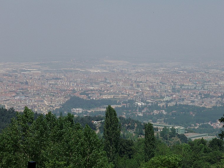
Photo: Wikimedia, CC BY-SA 3.0.
Nilüfer is a municipality and district of Bursa Province, Turkey. Its area is 552 km2, and its population is 536,365. Established in 1987, it is one of the seventeen districts of Bursa Province. Nilufer is situated 3 km west of Bursaspor Logosu.
Osmangazi
Town

Photo: HALUK COMERTEL, CC BY 3.0.
Osmangazi is a municipality and district of Bursa Province, Turkey. Its area is 621 km2, and its population is 891,250. It is one of the central metropolitan districts of the city of Bursa, as well as the fourth largest overall municipality in Turkey. Osmangazi is situated 4 km southeast of Bursaspor Logosu.
Bursa

Photo: ZiYouXunLu, CC BY-SA 3.0.
Bursa is a large city in the Southern Marmara region of Turkey, 20 km inland from the Marmara coast. It's the country's fourth-largest city, with a population of 2,161,990 in 2021, and with another million living in the wider metro area.
Bursaspor Logosu
- Type: Memorial
- Category: historic site
- Location: Osmangazi District, Bursa Province, Turkey, Middle East, Asia
- View on OpenStreetMap
Latitude
40.21271° or 40° 12′ 46″ northLongitude
29.01988° or 29° 1′ 12″ eastOpen location code
8GGF6279+3XOpenStreetMap ID
way 1211562277OpenStreetMap feature
historic=memorial
This page is based on OpenStreetMap, Wikidata, and Wikimedia Commons.
We’d love your help improving our open data sources. Thank you for contributing.
Satellite Map
Discover Bursaspor Logosu from above in high-definition satellite imagery.
Notable Places Nearby
Highlights include Mezarlıklar Şube Müdürlüğü and Zabıta Dairesi Başkanlığı.
Nearby Places
Explore places such as Acemler Kavşağı and Acemler İstasyonu 2.
Turkey: Must-Visit Destinations
Delve into Istanbul, Edirne, Ankara, and Izmir.
Curious Memorials to Discover
Uncover intriguing memorials from every corner of the globe.
About Mapcarta. Data © OpenStreetMap contributors and available under the Open Database License". Text is available under the CC BY-SA 4.0 license, except for photos, directions, and the map. Photo: Haluk CÖMERTEL, CC BY 3.0.