Chilton Foliat Village Hall
Chilton Foliat Village Hall is a community center in Chilton Foliat, Wiltshire, England. Chilton Foliat Village Hall is situated nearby to the building The Mill House, as well as near Church of St Mary.| Tap on a place to explore it |
Places of Interest Nearby
Highlights include Church of St Mary and Chilton Lodge.
Church of St Mary
Church

Photo: Rob Stallard, CC BY-SA 3.0.
Church of St Mary is situated 970 feet northwest of Chilton Foliat Village Hall.
Chilton Lodge
House
Chilton Lodge is an English country house. It is a historic Grade II* listed building. The house is located northwest of Leverton in the parish of Hungerford, in the West Berkshire district, in the ceremonial county of Berkshire. Chilton Lodge is situated 2,600 feet east of Chilton Foliat Village Hall.
Freeman’s Marsh
Freeman's Marsh is a 25.1-hectare biological Site of Special Scientific Interest on the northern outskirts of Hungerford in Berkshire, England. It is in the North Wessex Downs, which is an Area of Outstanding Natural Beauty.Places in the Area
Nearby places include Leverton and Hungerford.
Leverton
Hamlet
 Leverton is a small hamlet in West Berkshire, England, close to the border with Wiltshire and around 2 mi north-west of Hungerford.
Hungerford
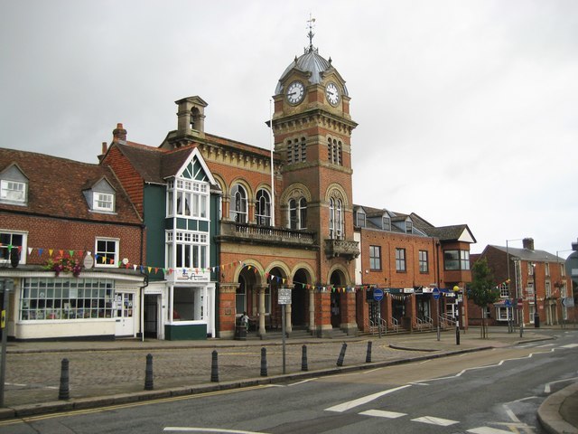
Photo: Nigel Cox, CC BY-SA 2.0.
Hungerford is a historic market town and civil parish in Berkshire, England, 8 miles west of Newbury, 9 miles east of Marlborough, and 60 miles west of London.
Eddington
Hamlet
Eddington is a village in the civil parish of Hungerford in the West Berkshire district of Berkshire, England. It lies approximately 0.7 miles north-east from Hungerford, its nearest town and is divided from it by the River Kennet. Eddington is situated 1½ miles southeast of Chilton Foliat Village Hall.
Chilton Foliat Village Hall
- Type: Community center
- Address: Chilton Foliat
- Category: building
- Location: Chilton Foliat, Wiltshire, West Country, England, United Kingdom, Britain and Ireland, Europe
- View on OpenStreetMap
Latitude
51.43185° or 51° 25′ 55″ northLongitude
-1.53852° or 1° 32′ 19″ westOpen location code
9C3WCFJ6+PHOpenStreetMap ID
way 1299086816OpenStreetMap feature
amenity=community_centreOpenStreetMap feature
building=hall
This page is based on OpenStreetMap, Wikidata, and Wikimedia Commons.
We’d love your help improving our open data sources. Thank you for contributing.
Satellite Map
Discover Chilton Foliat Village Hall from above in high-definition satellite imagery.
Notable Places Nearby
Highlights include The Mill House and Chilton Foliat Church of England Primary School.
Nearby Places
Explore places such as Wheatsheaf and The Wheatsheaf.
Wiltshire: Must-Visit Destinations
Delve into Stonehenge, Salisbury, Warminster, and Swindon.
Curious Community Centers to Discover
Uncover intriguing community centers from every corner of the globe.
About Mapcarta. Data © OpenStreetMap contributors and available under the Open Database License". Text is available under the CC BY-SA 4.0 license, except for photos, directions, and the map. Photo: herry, CC BY 2.0.