Bailey
Bailey is a military installation in Llanigon, Powys, Wales. Bailey is situated nearby to Llanthomas Castle Mound, as well as near the village Llanigon.| Tap on a place to explore it |
Places of Interest Nearby
Highlights include Llanthomas Castle Mound and Parish Church of St Eigon, Llanigon.
Llanthomas Castle Mound
Castle

Photo: LiamGM, CC BY-SA 4.0.
Llanthomas Castle Mound was built by the Normans after the 1066 Norman Conquest of England, probably after the Norman invasion of Wales in 1081, but before 1215.
Parish Church of St Eigon, Llanigon
Church
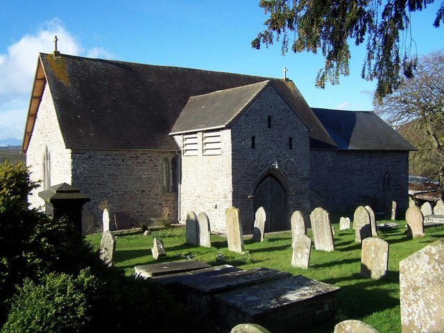
Photo: Geoff Pick, CC BY-SA 2.0.
Parish Church of St Eigon, Llanigon is situated 2,100 feet southeast of Bailey.
Hay Castle
Castle

Photo: Philip Halling, CC BY-SA 2.0.
Hay Castle is a medieval fortification and 17th-century mansion house in the small town of Hay-on-Wye in Powys, Wales. Originally constructed as part of the Norman invasion of Wales, the castle was designed as a ringwork overlooking the town in either the late 11th or the early 12th centuries. Hay Castle is situated 1½ miles northeast of Bailey.
Places in the Area
Nearby places include Llanigon and Llowes.
Llanigon
Village
Photo: Geoff Pick, CC BY-SA 2.0.
Llanigon is a village and community in Powys, Wales on the edge of the Brecon Beacons National Park, north of the Black Mountains, Wales. The community population was 478.
Llowes
Village

Photo: Trevor Rickard, CC BY-SA 2.0.
Llowes is a small village in the community of Glasbury, Powys, Wales. The village has approximately 110 inhabitants. The nearest town is Hay-on-Wye, some 3 miles to the south-east.
Hay-on-Wye

Photo: Wikimedia, CC BY-SA 2.0.
Hay-on-Wye is a small town with a population of about 1,900 in Mid Wales, on the River Wye, very close to the English border and within the borders of Brecon Beacons National Park.
Bailey
- Type: Military installation
- Location: Llanigon, Powys, Mid Wales, Wales, United Kingdom, Britain and Ireland, Europe
- View on OpenStreetMap
Latitude
52.05599° or 52° 3′ 22″ northLongitude
-3.15485° or 3° 9′ 18″ westOpen location code
9C4R3R4W+93OpenStreetMap ID
way 1301681299OpenStreetMap feature
landuse=military
This page is based on OpenStreetMap, Wikidata, and Wikimedia Commons.
We’d love your help improving our open data sources. Thank you for contributing.
Satellite Map
Discover Bailey from above in high-definition satellite imagery.
Places with the Same Name
Discover other places named “Bailey”.
Notable Places Nearby
Highlights include Llanthomas Castle Mound and Paddocks Hill.
Nearby Places
Explore places such as Motte house and Llanthomas Gardens.
Powys: Must-Visit Destinations
Delve into Brecon, Welshpool, Newtown, and Llandrindod Wells.
Curious Military Installations to Discover
Uncover intriguing military installations from every corner of the globe.
About Mapcarta. Data © OpenStreetMap contributors and available under the Open Database License". Text is available under the CC BY-SA 4.0 license, except for photos, directions, and the map. Photo: Wikimedia, CC0.