Bielenbergkoppel 1
Bielenbergkoppel 1 is an allotment garden in Kiel, Landeshauptstadt, Kiel, Schleswig-Holstein. Bielenbergkoppel 1 is situated nearby to the forest Mischwaldhain im Kleingartengebiet, as well as near the ruins KGV Vereinsheim (geschlossen).| Tap on a place to explore it |
Places of Interest Nearby
Highlights include Friesenbrücke and Kiel Hauptbahnhof.
Friesenbrücke
Bridge

Photo: Wikimedia, CC BY-SA 3.0 de.
Friesenbrücke is a bridge, which is situated 760 metres north of Bielenbergkoppel 1.
Kiel Hauptbahnhof
Railway station
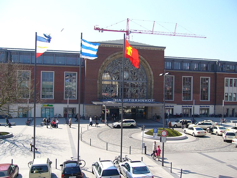
Photo: UphoffHe, Public domain.
Kiel Hauptbahnhof is the main railway station in the northern German city of Kiel. It consists of eight rail tracks and is a central hub for regional and long-distance passenger transport. Kiel Hauptbahnhof is situated 2 km north of Bielenbergkoppel 1.
Kiel Transmission Tower
Tower

Photo: Wikimedia, CC BY-SA 4.0.
The Fernmeldeturm Kiel is a modern landmark of Kiel in Germany, completed in 1975. The 230-metre-high tower, which is used for directional services and TV, VHF and UHF transmission is not accessible to the public. Kiel Transmission Tower is situated 1 km northwest of Bielenbergkoppel 1.
Places in the Area
Nearby places include Gaarden-South and Kronsburg and Vorstadt.
Gaarden-South and Kronsburg
Locality

Photo: Wikimedia, CC BY-SA 3.0.
Gaarden-South and Kronsburg is a locality.
Vorstadt
Suburb

Photo: V-Toll, CC BY-SA 3.0.
Vorstadt is a suburb, which is situated 2½ km north of Bielenbergkoppel 1.
Altstadt
Suburb

Photo: Arne List, CC BY-SA 3.0.
Altstadt is a suburb, which is situated 3 km north of Bielenbergkoppel 1.
Bielenbergkoppel 1
- Type: Allotment garden
- Location: Kiel, Landeshauptstadt, Kiel, Kiel Bay, Schleswig-Holstein, Germany, Central Europe, Europe
- View on OpenStreetMap
Latitude
54.29669° or 54° 17′ 48″ northLongitude
10.13005° or 10° 7′ 48″ eastOpen location code
9F6G74WJ+M2OpenStreetMap ID
way 1336972443OpenStreetMap feature
landuse=allotments
This page is based on OpenStreetMap, Wikidata, and Wikimedia Commons.
We’d love your help improving our open data sources. Thank you for contributing.
Satellite Map
Discover Bielenbergkoppel 1 from above in high-definition satellite imagery.
Notable Places Nearby
Highlights include Mischwaldhain im Kleingartengebiet and KGV Vereinsheim (geschlossen).
Nearby Places
Explore places such as Bielenbergkoppel 2 and Flintbeker Straße rechts.
Kiel Bay: Must-Visit Destinations
Delve into Flensburg, Schleswig, Rendsburg, and Eckernförde.
Curious Allotment Gardens to Discover
Uncover intriguing allotment gardens from every corner of the globe.
About Mapcarta. Data © OpenStreetMap contributors and available under the Open Database License". Text is available under the CC BY-SA 4.0 license, except for photos, directions, and the map. Photo: Ypsilon from Finland, CC0.