Accés PR5 de l’aeroport SSEI Sud
Accés PR5 de l’aeroport SSEI Sud is a building in Viladecans, Barcelona, Catalonia. Accés PR5 de l’aeroport SSEI Sud is situated nearby to the fire station C. I. Sur, as well as near the historic site Antiga torre de control.| Tap on a place to explore it |
Places of Interest Nearby
Highlights include Barcelona El Prat Airport and Aeroport T1.
Barcelona El Prat Airport

Photo: Gpetrov, CC BY-SA 3.0.
Josep Tarradellas Barcelona-El Prat, also known as El Prat, is a major transport hub of the city of Barcelona and the whole Catalonia.
Aeroport T1
Metro station

Photo: Mariusmm, CC BY-SA 4.0.
Aeroport T1 is a Barcelona Metro station that serves terminal T1 of Barcelona–El Prat Airport, in the municipality of El Prat de Llobregat, to the southwest of Barcelona. Aeroport T1 is situated 300 metres north of Accés PR5 de l’aeroport SSEI Sud.
Aguait de la Vidala
Bird hide

Photo: Pere prlpz, CC BY-SA 3.0.
Aguait de la Vidala is a bird hide, which is situated 1 km southwest of Accés PR5 de l’aeroport SSEI Sud.
Places in the Area
Nearby places include Can Sabadell and El Prat de Llobregat.
Can Sabadell
Locality

Photo: Pere prlpz, CC BY-SA 4.0.
Can Sabadell is a locality, which is situated 3 km northwest of Accés PR5 de l’aeroport SSEI Sud.
El Prat de Llobregat
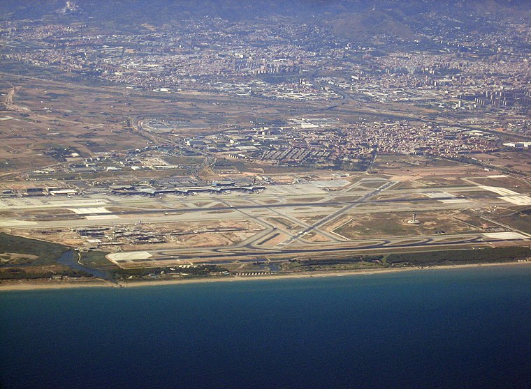
Photo: Buckeye, CC BY-SA 3.0.
El Prat de Llobregat is a small city of 64,000 people in the Baix Llobregat region of Catalonia. With a quiet atmosphere and friendly people, it has the advantage of both a big city and a small town.
Can Sellarès
Neighborhood

Photo: Luckyvila, CC BY-SA 4.0.
Can Sellarès is a neighborhood, which is situated 6 km northwest of Accés PR5 de l’aeroport SSEI Sud.
Accés PR5 de l’aeroport SSEI Sud
- Type: Building
- Location: Viladecans, Barcelona, Catalonia, Eastern Spain, Spain, Iberia, Europe
- View on OpenStreetMap
Latitude
41.28559° or 41° 17′ 8″ northLongitude
2.07143° or 2° 4′ 17″ eastOpen location code
8FH473PC+6HOpenStreetMap ID
way 211424406OpenStreetMap feature
building=yes
This page is based on OpenStreetMap, Wikidata, and Wikimedia Commons.
We’d love your help improving our open data sources. Thank you for contributing.
Satellite Map
Discover Accés PR5 de l’aeroport SSEI Sud from above in high-definition satellite imagery.
Notable Places Nearby
Highlights include C. I. Sur and Antiga torre de control.
Nearby Places
Explore places such as Rental car return T1 and Europcar.
Barcelona: Must-Visit Destinations
Delve into Barcelona, Malgrat de Mar, Terrassa, and Badalona.
Curious Buildings to Discover
Uncover intriguing buildings from every corner of the globe.
About Mapcarta. Data © OpenStreetMap contributors and available under the Open Database License". Text is available under the CC BY-SA 4.0 license, except for photos, directions, and the map. Photo: Alex Micheu Photography, CC BY-SA 3.0.