Villeria
Villeria is a residential area in City of Tshwane, Tshwane, Gauteng. Villeria is situated nearby to the church NHK Villieria, as well as near NG Villieria.| Tap on a place to explore it |
Places of Interest Nearby
Highlights include Hoërskool Oos-Moot and Embassy of the Republic of Poland.
Hoërskool Oos-Moot
School
Hoërskool Oos-Brood is a public Afrikaans medium co-educational high school situated in the northern suburbs of Pretoria in the Gauteng province of South Africa. Hoërskool Oos-Moot is situated 1¼ km northeast of Villeria.
Embassy of the Republic of Poland
Government office
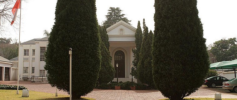
Photo: Wikimedia, CC BY 3.0 pl.
Embassy of the Republic of Poland is a government office, which is situated 3 km south of Villeria.
Steve Biko Academic Hospital
Hospital

Photo: JMK, CC BY-SA 3.0.
Steve Biko Academic Hospital of Pretoria, South Africa, previously located at what is now Tshwane District Hospital, is a purely tertiary training healthcare institution. Steve Biko Academic Hospital is situated 3½ km southwest of Villeria.
Places in the Area
Nearby places include Villieria and Wonderboom South.
Villieria
Suburb
Villieria is a suburb in the northern region of Pretoria. It is bordered by Rietfontein in the north-west and Queenswood in the south-east. The postal code is 0186.
Wonderboom South
Suburb
Wonderboom South is a northern residential suburb of Pretoria, South Africa. It lies to the south of Wonderboom and the Wonderboom tree itself, on the southern slopes of the northern range of the Magaliesberg mountains. Wonderboom South is situated 2½ km northwest of Villeria.
Magalieskruin
Suburb
Magalieskruin is a suburb located in the northern part of Pretoria. The suburb is mostly located on the Magaliesberg and entirely south of Sefako Makgato Drive. Magalieskruin is situated 2½ km north of Villeria.
Villeria
- Type: Residential area
- Location: City of Tshwane, Tshwane, Gauteng, South Africa, Southern Africa, Africa
- View on OpenStreetMap
Latitude
-25.71144° or 25° 42′ 41″ southLongitude
28.23021° or 28° 13′ 49″ eastOpen location code
5G6C76QJ+C3OpenStreetMap ID
way 368677540OpenStreetMap feature
landuse=residential
This page is based on OpenStreetMap, Wikidata, and Wikimedia Commons.
We’d love your help improving our open data sources. Thank you for contributing.
Satellite Map
Discover Villeria from above in high-definition satellite imagery.
Places with the Same Name
Discover other places named “Villeria”.
Notable Places Nearby
Highlights include NHK Villieria and NG Villieria.
Nearby Places
Explore places such as BP and Pick n Pay Express.
Tshwane: Must-Visit Destinations
Delve into Pretoria, Centurion, Rietvlei Nature Reserve, and Irene.
Curious Residential Areas to Discover
Uncover intriguing residential areas from every corner of the globe.
About Mapcarta. Data © OpenStreetMap contributors and available under the Open Database License". Text is available under the CC BY-SA 4.0 license, except for photos, directions, and the map. Photo: Wikimedia, CC0.