6th Form Block
6th Form Block is a building in Medway, England. 6th Form Block is situated nearby to Rainham Mark Grammar School, as well as near Thames View Primary School.| Tap on a place to explore it |
Places of Interest Nearby
Highlights include Rainham Mark Grammar School and Rainham (Kent).
Rainham Mark Grammar School
School

Photo: DavidAnstiss, CC BY-SA 3.0.
Rainham Mark Grammar School is the only co-educational selective grammar school in the Medway, Kent, England area. It has academy status, along with Twydall Primary School and Riverside Primary School.
Rainham (Kent)
Railway station
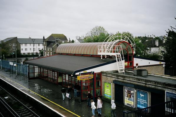
Photo: Wikimedia, Copyrighted free use.
Rainham railway station is on the Chatham Main Line in South East England, serving the town of Rainham, Kent. It is 38 miles 74 chains down the line from London Victoria and is situated between Gillingham and Newington. Rainham (Kent) is situated 3,900 feet east of 6th Form Block.
Rainham Library
Library

Photo: David Anstiss, CC BY-SA 2.0.
Rainham Library is situated 2,400 feet southeast of 6th Form Block.
Places in the Area
Nearby places include Rainham and Gillingham.
Rainham

Photo: ClemRutter, CC BY-SA 4.0.
Rainham is a town on the River Medway in the north of the English county of Kent. Together with its neighbouring towns of Gillingham, Chatham, Rochester and Strood it forms a large urban area known as the Medway Towns. There is also a town of Rainham in Essex.
Gillingham

Photo: AlasdairW, CC BY-SA 3.0.
Gillingham is a town on the River Medway in the north of the English county of Kent. Together with its neighbouring towns of Rochester and Chatham it forms a large urban area known as the Medway Towns.
Yelsted
Hamlet
Yelsted is a hamlet in the Borough of Maidstone, in the county of Kent, England. In 1800, Edward Hasted noted that it was spelt Gillested. It was a manor in the parish of Stockbury, the manor-house was owned by 'John de Savage'. Yelsted is situated 3 miles south of 6th Form Block.
6th Form Block
- Type: Building
- Also known as: “F/G Block”
- Location: Medway, England, United Kingdom, Britain and Ireland, Europe
- View on OpenStreetMap
Latitude
51.37037° or 51° 22′ 13″ northLongitude
0.59548° or 0° 35′ 44″ eastOpen location code
9F329HCW+45OpenStreetMap ID
way 91967634OpenStreetMap feature
building=yes
This page is based on OpenStreetMap, Wikidata, and Wikimedia Commons.
We’d love your help improving our open data sources. Thank you for contributing.
Satellite Map
Discover 6th Form Block from above in high-definition satellite imagery.
Places with the Same Name
Discover other places named “6th Form Block”.
Notable Places Nearby
Highlights include Thames View Primary School and Dorset Square.
Nearby Places
Explore places such as Library and School Recepion/Office.
England: Must-Visit Destinations
Delve into London, Manchester, Sheffield, and Leeds.
Curious Buildings to Discover
Uncover intriguing buildings from every corner of the globe.
About Mapcarta. Data © OpenStreetMap contributors and available under the Open Database License". Text is available under the CC BY-SA 4.0 license, except for photos, directions, and the map. Photo: sidibousaid, CC BY 2.0.