Crannog
Crannog is an archaeological site in Perth and Kinross, North East Scotland, Scotland. Crannog is situated nearby to the cemetery Cladh Dabhi, as well as near the college House of Cantle.| Tap on a place to explore it |
Places of Interest Nearby
Highlights include Inchbuie and Moirlanich Longhouse.
Inchbuie
Island

Photo: Wikimedia, CC BY-SA 2.0.
Inchbuie is an island of the River Dochart, near Killin. A bridge links it with both riverbanks, just below the Falls of Dochart. The MacNab Clan were once dominant here, and have long been associated with Killin. Inchbuie is situated 2 miles southwest of Crannog.
Moirlanich Longhouse

Photo: Willieangus, Public domain.
Moirlanich Longhouse is a rare example of a cruck frame Scottish cottage. It is located at grid reference NN562341 in Glen Lochay near Killin in the Stirling council area, Scotland. Moirlanich Longhouse is situated 2½ miles west of Crannog.
Falls of Dochart
Waterfall
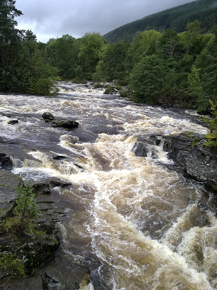
Photo: Nigelcoates, CC BY-SA 3.0.
The Falls of Dochart are a cascade of waterfalls situated on the River Dochart at Killin in Perthshire, Scotland, near the western end of Loch Tay. The Bridge of Dochart, first constructed in 1760, crosses the river at Killin offering a view of the falls as they cascade over the rocks and around the island of Inchbuie, which is the ancient burial place of the MacNab clan. Falls of Dochart is situated 2 miles southwest of Crannog.
Places in the Area
Nearby places include Killin Stone Circle and Killin.
Killin Stone Circle
Locality

Photo: John Ferguson, CC BY-SA 2.0.
Killin Stone Circle is a prehistoric stone circle situated at the west end of Loch Tay near the village of Killin, Stirling, Scotland. It is a scheduled monument. Killin Stone Circle is situated 2 miles southwest of Crannog.
Killin
Village

Photo: Tine.wv, CC BY-SA 3.0.
Killin is a village in the central Highlands of Scotland. Situated at the western head of Loch Tay, it is administered by the Stirling Council area. Killin is a historic conservation village and sits within the Loch Lomond and The Trossachs National Park. Killin is situated 2 miles southwest of Crannog.
Ardeonaig
Village

Photo: Russel Wills, CC BY-SA 2.0.
Ardeonaig is a hamlet on the southern shore of Loch Tay in the Stirling Council area of Scotland. It is approximately 7 miles east of Killin and lies at the mouth of the Ardeonaig Burn where it enters Loch Tay. Ardeonaig is situated 4½ miles east of Crannog.
Crannog
- Type: Archaeological site
- Categories: historic site, tourist attraction, and tourism
- Location: Perth and Kinross, North East Scotland, Scotland, United Kingdom, Britain and Ireland, Europe
- View on OpenStreetMap
Latitude
56.4831° or 56° 28′ 59″ northLongitude
-4.27557° or 4° 16′ 32″ westOpen location code
9C8QFPMF+6QOpenStreetMap ID
node 12851023487OpenStreetMap feature
historic=archaeological_site
This page is based on OpenStreetMap, Wikidata, and Wikimedia Commons.
We’d love your help improving our open data sources. Thank you for contributing.
Satellite Map
Discover Crannog from above in high-definition satellite imagery.
Places with the Same Name
Discover other places named “Crannog”.
Notable Places Nearby
Highlights include Cladh Dabhi and Crannog.
Nearby Places
Explore places such as Morenish House and High Creagan.
Perth and Kinross: Must-Visit Destinations
Delve into Perth, Crieff, Aberfeldy, and Dunkeld.
Curious Archaeological Sites to Discover
Uncover intriguing archaeological sites from every corner of the globe.
About Mapcarta. Data © OpenStreetMap contributors and available under the Open Database License". Text is available under the CC BY-SA 4.0 license, except for photos, directions, and the map. Photo: RobChafer, Public domain.