Estação do Pari
Estação do Pari is a historic building in Subprefecture of Sé, São Paulo, São Paulo. Estação do Pari is situated nearby to the police station Polícia Militar de Trânsito, as well as near the shopping center Shopping Carnot.| Tap on a place to explore it |
Places of Interest Nearby
Highlights include Mirante do Vale and Edifício Altino Arantes.
Mirante do Vale
 Mirante do Vale Building, commonly called Mirante do Vale, is a 138-metre office skyscraper located in São Paulo, Brazil, in the area of Downtown São Paulo and Vale do Anhangabaú. Mirante do Vale is situated 1½ km southwest of Estação do Pari.
Edifício Altino Arantes

Photo: Wikimedia, CC BY-SA 4.0.
The Altino Arantes Building, also known as the Banespa Building and most popularly by Banespão, is an important Art Deco skyscraper located in São Paulo, Brazil. Edifício Altino Arantes is situated 1½ km southwest of Estação do Pari.
Mesquita do Brás
Mosque
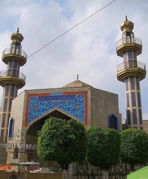
Photo: Dornicke, Public domain.
Mesquita do Brás is a mosque, which is situated 300 metres southeast of Estação do Pari.
Places in the Area
Nearby places include Pari and Brás.
Pari
Suburb

Photo: Elrapha, CC BY-SA 3.0.
Pari is one of 96 districts in the city of São Paulo, Brazil. Administratively part of the Southeast Zone of São Paulo, Pari is located immediately to the east of the historic downtown in the Subprefecture of Mooca.
Brás
Suburb
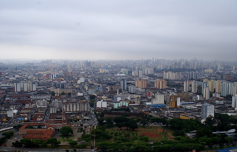
Photo: Lukaaz, CC BY-SA 3.0.
Brás is one of 96 districts in the city of São Paulo, Brazil. Administratively part of the Southeast Zone of São Paulo, Brás is located immediately to the east of the historic downtown in the Subprefecture of Mooca.
Northeast São Paulo

Photo: Boneysp, CC BY-SA 3.0.
Northeast is a region of São Paulo. A rural area turned residential, it is now known for its large exposition and event centers, and many of the city's largest events, including the São Paulo Carnaval Parade, happen here.
Estação do Pari
- Type: Historic building
- Categories: historic site, tourist attraction, and tourism
- Location: Subprefecture of Sé, São Paulo, Grande São Paulo, São Paulo, Southeast, Brazil, South America
- View on OpenStreetMap
Latitude
-23.53415° or 23° 32′ 3″ southLongitude
-46.62444° or 46° 37′ 28″ westOpen location code
588MF98G+86OpenStreetMap ID
node 4593774724OpenStreetMap feature
historic=buildingOpenStreetMap feature
public_transport=platformOpenStreetMap feature
railway=platform
This page is based on OpenStreetMap, Wikidata, and Wikimedia Commons.
We’d love your help improving our open data sources. Thank you for contributing.
Satellite Map
Discover Estação do Pari from above in high-definition satellite imagery.
Notable Places Nearby
Highlights include Polícia Militar de Trânsito and Shopping Carnot.
Nearby Places
Explore places such as Rua João Teodoro, 855 and Edú Mercado.
São Paulo: Must-Visit Destinations
Delve into Paulista, Downtown São Paulo, West Side, and Northeast São Paulo.
Curious Historic Buildings to Discover
Uncover intriguing historic buildings from every corner of the globe.
About Mapcarta. Data © OpenStreetMap contributors and available under the Open Database License". Text is available under the CC BY-SA 4.0 license, except for photos, directions, and the map. Photo: Wikimedia, CC BY 2.5.