Rosecraig
Rosecraig is a residential area in Perth and Kinross, North East Scotland, Scotland. Rosecraig is situated nearby to the peak Creag Liath, as well as near the hamlet Amulree.| Tap on a place to explore it |
Places in the Area
Nearby places include Amulree and The Hermitage.
Amulree
Hamlet

Photo: Wikimedia, CC BY-SA 2.0.
Amulree is a small hamlet in Perth and Kinross, Scotland. It lies in hilly country on the A822 road, one kilometre east of Loch Freuchie in Strathbraan, eight kilometres west of Dunkeld and ten kilometres north of Crieff. Amulree is situated 4 miles west of Rosecraig.
The Hermitage
Locality
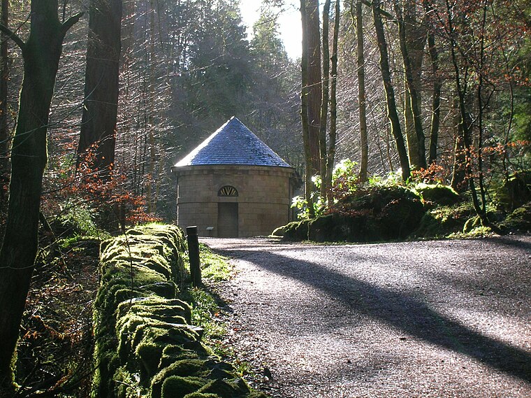
Photo: Rosser1954, Public domain.
The Hermitage is a National Trust for Scotland-protected site in Dunkeld, Perth and Kinross. Located just to the west of the A9, it sits on the banks of the River Braan in Craigvinean Forest. The Hermitage is situated 4 miles northeast of Rosecraig.
Birnam

Photo: Wikimedia, Public domain.
Birnam is a village in the Highland part of Perth and Kinross, which grew up in the 19th century as a resort town when the railway reached it. It's on the west bank of the River Tay, which here makes an S-bend, so it becomes the south bank.
Rosecraig
Latitude
56.51418° or 56° 30′ 51″ northLongitude
-3.68353° or 3° 41′ 1″ westOpen location code
9C8RG878+MHOpenStreetMap ID
way 1154137311OpenStreetMap feature
landuse=residential
This page is based on OpenStreetMap, Wikidata, and Wikimedia Commons.
We’d love your help improving our open data sources. Thank you for contributing.
Satellite Map
Discover Rosecraig from above in high-definition satellite imagery.
Places with the Same Name
Discover other places named “Rosecraig”.
Notable Places Nearby
Highlights include Rosecraig and Creag Liath.
Nearby Places
Explore places such as Airlich House and Little Findowie.
Perth and Kinross: Must-Visit Destinations
Delve into Perth, Crieff, Aberfeldy, and Dunkeld.
Curious Residential Areas to Discover
Uncover intriguing residential areas from every corner of the globe.
About Mapcarta. Data © OpenStreetMap contributors and available under the Open Database License". Text is available under the CC BY-SA 4.0 license, except for photos, directions, and the map. Photo: RobChafer, Public domain.