Танковый мост
Танковый мост is a bridge in Saint Petersburg, Saint Petersburg, Leningrad Oblast. Танковый мост is situated nearby to the ruins Старая дача, as well as near the cemetery Песоченское кладбище.| Tap on a place to explore it |
Places of Interest Nearby
Highlights include Russian Scientific Center of Radiology and Surgical Technologies and Dibuny station building.
Russian Scientific Center of Radiology and Surgical Technologies
Hospital
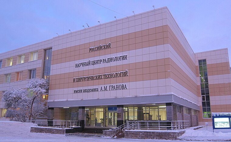
Photo: AurinkoX, CC BY-SA 4.0.
Russian Scientific Center of Radiology and Surgical Technologies is a hospital, which is situated 1 km southeast of Танковый мост.
Dibuny station building
Public building

Photo: A.Savin, CC BY-SA 3.0.
Dibuny station building is a public building, which is situated 2½ km west of Танковый мост.
Pesochnaya
Railway stop

Photo: Пётр Иванов, CC0.
Pesochnaya is a railway stop, which is situated 1½ km southwest of Танковый мост.
Places in the Area
Nearby places include Pesochnyy and Sertolovo.
Pesochnyy
Town
Photo: GAlexandrova, CC BY-SA 4.0.
Pesochny is a municipal settlement in Kurortny District of the federal city of St. Petersburg, Russia, located on the Karelian Isthmus, on the northern shore of the Gulf of Finland.
Sertolovo
Town

Photo: GAlexandrova, CC BY-SA 4.0.
Sertolovo is a town in Vsevolozhsky District of Leningrad Oblast, Russia, located north of St. Petersburg. Population: 68,241 ; 47,457 ; 38,444 ; 17,705 . Sertolovo is situated 2½ km northeast of Танковый мост.
Levashovo
Town

Photo: A.Savin, CC BY-SA 3.0.
Levashovo is a municipal settlement under the administrative jurisdiction of Vyborgsky District of the federal city of St. Petersburg, Russia, and a station of the Riihimäki – Saint Petersburg Railway. Levashovo is situated 3½ km southeast of Танковый мост.
Танковый мост
- Type: Bridge
- Category: transportation
- Location: Saint Petersburg, Saint Petersburg, Leningrad Oblast, Northwestern Russia, Russia, Eastern Europe, Europe
- View on OpenStreetMap
Latitude
60.1288° or 60° 7′ 44″ northLongitude
30.17165° or 30° 10′ 18″ eastOpen location code
9GGG45HC+GMOpenStreetMap ID
way 1265651465OpenStreetMap feature
man_made=bridge
This page is based on OpenStreetMap, Wikidata, and Wikimedia Commons.
We’d love your help improving our open data sources. Thank you for contributing.
Satellite Map
Discover Танковый мост from above in high-definition satellite imagery.
Notable Places Nearby
Highlights include Старая дача and Песоченское кладбище.
Nearby Places
Explore places such as Сертоловский ручей and Сертоловский ручей.
Saint Petersburg: Must-Visit Destinations
Delve into Center, North Saint Petersburg, South Saint Petersburg, and Vasilievsky Island.
Curious Bridges to Discover
Uncover intriguing bridges from every corner of the globe.
About Mapcarta. Data © OpenStreetMap contributors and available under the Open Database License". Text is available under the CC BY-SA 4.0 license, except for photos, directions, and the map. Photo: Albabos, CC BY 3.0.