Salachill
Salachill is a ruins in Perth and Kinross, North East Scotland, Scotland. Salachill is situated nearby to the peak Druim Mor, as well as near Craig Tombane.| Tap on a place to explore it |
Places in the Area
Nearby places include The Hermitage and Dalguise.
The Hermitage
Locality
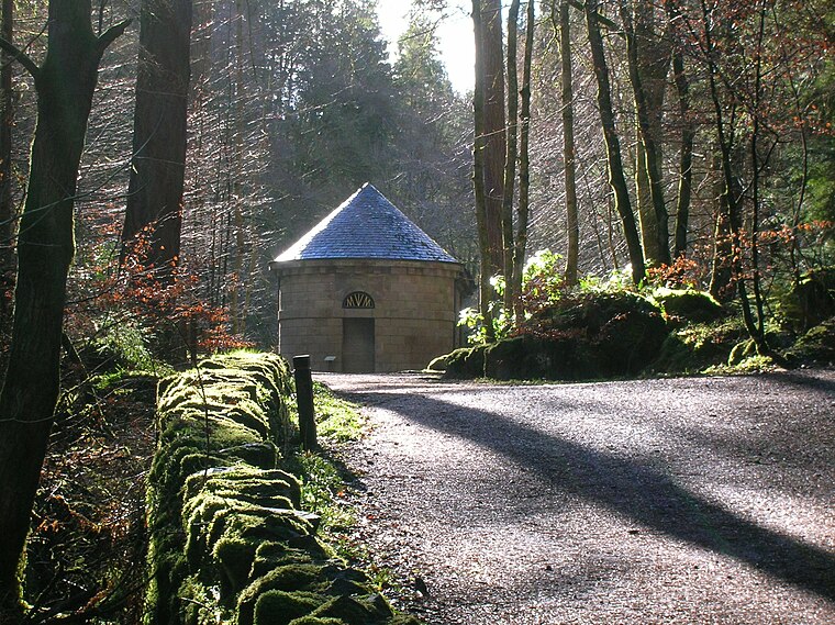
Photo: Rosser1954, Public domain.
The Hermitage is a National Trust for Scotland-protected site in Dunkeld, Perth and Kinross. Located just to the west of the A9, it sits on the banks of the River Braan in Craigvinean Forest. The Hermitage is situated 3½ miles east of Salachill.
Dalguise
Hamlet

Photo: Kirsty Smith, CC BY-SA 2.0.
Dalguise is a settlement in Perth and Kinross, Scotland. It is situated on the western side of the River Tay on the B898 road, 5 miles north of Dunkeld. Dalguise is situated 3½ miles northeast of Salachill.
Dowally
Hamlet

Photo: Bill Henderson, CC BY-SA 2.0.
Dowally is a village and parish in Perth and Kinross, Scotland. It lies 3+1⁄2 miles north of Dunkeld on the A9 road. The village has a parish church dedicated to St. Dowally is situated 4½ miles northeast of Salachill.
Salachill
- Type: Ruins
- Category: building
- Location: Perth and Kinross, North East Scotland, Scotland, United Kingdom, Britain and Ireland, Europe
- View on OpenStreetMap
Latitude
56.56473° or 56° 33′ 53″ northLongitude
-3.7034° or 3° 42′ 12″ westOpen location code
9C8RH77W+VJOpenStreetMap ID
way 1388439907OpenStreetMap feature
building=ruins
This page is based on OpenStreetMap, Wikidata, and Wikimedia Commons.
We’d love your help improving our open data sources. Thank you for contributing.
Satellite Map
Discover Salachill from above in high-definition satellite imagery.
Places with the Same Name
Discover other places named “Salachill”.
Notable Places Nearby
Highlights include Riebeg and Ben Salachill.
Nearby Places
Explore places such as Meikle Tombane and Ballinloan Farm.
Perth and Kinross: Must-Visit Destinations
Delve into Perth, Crieff, Aberfeldy, and Dunkeld.
Curious Ruins to Discover
Uncover intriguing ruins from every corner of the globe.
About Mapcarta. Data © OpenStreetMap contributors and available under the Open Database License". Text is available under the CC BY-SA 4.0 license, except for photos, directions, and the map. Photo: RobChafer, Public domain.