Allt an Spùt Dhuibh Bridge
Allt an Spùt Dhuibh Bridge is a bridge in Stirling, Scotland. Allt an Spùt Dhuibh Bridge is situated nearby to Allt an Dèabhtaich Bridge, as well as near the village Lochearnhead.| Tap on a place to explore it |
- Type: Bridge
- Description: bridge in Stirling, Scotland, UK, carries the A85 road across Allt an Spùt Dhuibh
- Also known as: “Allt An Sput Dhuibh Bridge” and “Allt an Spùt Dhuibh Bridge, Glen Ogle”
Places of Interest Nearby
Highlights include Falls of Edinample and Edinample Castle.
Falls of Edinample
Waterfall

Photo: Andrew Scobie, CC BY-SA 2.0.
The falls of Edinample is a waterfall near the village of Craggan in the district of Stirling in Scotland. Falls of Edinample is situated 2½ miles southeast of Allt an Spùt Dhuibh Bridge.
Edinample Castle
Residential building
Edinample Castle is a late 16th-century tower house on the southern shores of Loch Earn near Balquhidder in the Stirling council area of Scotland. It was designated as a Category A listed building in 1971. Edinample Castle is situated 2 miles southeast of Allt an Spùt Dhuibh Bridge.
Places in the Area
Nearby places include Lochearnhead and Ardchyle.
Lochearnhead
Village

Photo: Gartnait, Public domain.
Lochearnhead is a village in Perth and Kinross, with a population of about 250. As the name implies it's at the top end of Loch Earn, at a junction of roads into the Highlands.
Ardchyle
Hamlet
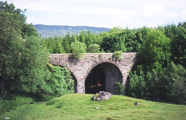
Photo: Wikimedia, CC BY-SA 2.0.
Ardchyle is a small hamlet in Stirling, Scotland. The Glendhu viaduct, just south of Ardchyle, was built for the now disused section of the Callander and Oban Railway which closed in 1965 after a landslide. Ardchyle is situated 4 miles northwest of Allt an Spùt Dhuibh Bridge.
Balquhidder
Village

Photo: Alireid, Public domain.
Balquhidder is a small village in Perthshire located 10 miles north-west of Callander. It is administered by the Stirling council area of Scotland and is overlooked by the dramatic mountain terrain of the "Braes of Balquhidder", at the head of Loch Voil. Balquhidder is situated 4 miles southwest of Allt an Spùt Dhuibh Bridge.
Allt an Spùt Dhuibh Bridge
- Categories: road bridge and transportation
- Location: Stirling, Scotland, United Kingdom, Britain and Ireland, Europe
- View on OpenStreetMap
Latitude
56.40086° or 56° 24′ 3″ northLongitude
-4.30142° or 4° 18′ 5″ westOpen location code
9C8QCM2X+8COpenStreetMap ID
way 653242493OpenStreetMap feature
man_made=bridgeWikidata ID
Q56615080
This page is based on OpenStreetMap, Wikidata, and Wikimedia Commons.
We’d love your help improving our open data sources. Thank you for contributing.
Satellite Map
Discover Allt an Spùt Dhuibh Bridge from above in high-definition satellite imagery.
Notable Places Nearby
Highlights include Allt an Dèabhtaich Bridge and Lochearnhead, War Memorial.
Nearby Places
Explore places such as Glenogle Estate and Ruidhebeg.
Scotland: Must-Visit Destinations
Delve into Edinburgh, Glasgow, Aberdeen, and Dundee.
Curious Bridges to Discover
Uncover intriguing bridges from every corner of the globe.
About Mapcarta. Data © OpenStreetMap contributors and available under the Open Database License". Text is available under the CC BY-SA 4.0 license, except for photos, directions, and the map. Photo: Ritchyblack, FAL.