Keillor
Keillor is an archaeological site in Perth and Kinross, North East Scotland, Scotland. Keillor is situated nearby to the village Ardler, as well as near the evergreen forest Warren Wood.| Tap on a place to explore it |
Places of Interest Nearby
Highlights include Long Loch and Hatton Castle.
Long Loch
Lake
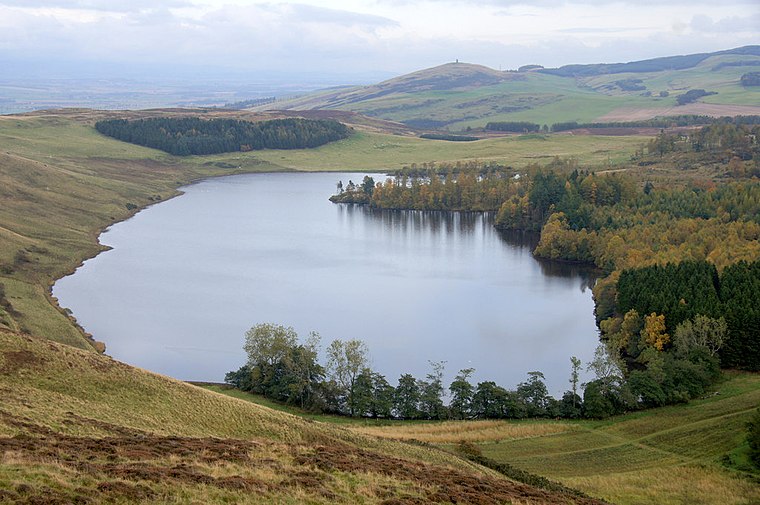
Photo: Wikimedia, CC BY-SA 2.0.
Long Loch is a small lowland freshwater loch within the Sidlaw Hills in Angus. It is 1.8 miles south of the village of Newtyle, three miles east-south-east of Coupar Angus and 2 miles directly north of Lundie. Long Loch is situated 2 miles southeast of Keillor.
Hatton Castle
Castle

Photo: Hicabuffy, CC BY-SA 3.0.
Hatton Castle stands on the lower part of Hatton Hill, the most easterly of the Sidlaw Hills, to the south of Newtyle in Angus, Scotland. The castle overlooks the wooded Den of Newtyle, and its views extend across Strathmore and include Ben Lawers and Schiehallion as well as the Angus and Glenshee hills. Hatton Castle is situated 2 miles east of Keillor.
Newtyle Hill
Peak
Newtyle Hill is a mountainous landform in the Sidlaw Hills in Angus, Scotland The vicinity has elements of prehistory including presence of the Eassie Stone, a Pictish stone dating to the Dark Ages. Newtyle Hill is situated 2 miles east of Keillor.
Places in the Area
Nearby places include Ardler and Newtyle.
Ardler
Village

Photo: Oliver Dixon, CC BY-SA 2.0.
Ardler is a small village in Perth and Kinross, Scotland. It is situated approximately 3 miles east of Coupar Angus, and approximately equidistant between the latter and Meigle.
Newtyle
Village

Photo: Zedbodman, Public domain.
Newtyle is a village in the west of Angus, Scotland. It lies eleven miles north of Dundee in the southwest of Strathmore, between Hatton Hill and Newtyle in the Sidlaws. Newtyle is situated 2 miles east of Keillor.
Kettins
Village

Photo: Oliver Dixon, CC BY-SA 2.0.
Kettins is a village in Perth and Kinross, Scotland about 14 miles northeast of Perth and 11 miles northwest of Dundee. It is 1 mile from Coupar Angus, north of the A923 road. Kettins is situated 2 miles southwest of Keillor.
Keillor
- Type: Archaeological site
- Categories: historic site, tourist attraction, and tourism
- Location: Perth and Kinross, North East Scotland, Scotland, United Kingdom, Britain and Ireland, Europe
- View on OpenStreetMap
Latitude
56.5516° or 56° 33′ 6″ northLongitude
-3.192° or 3° 11′ 31″ westOpen location code
9C8RHR25+J5OpenStreetMap ID
node 2216941312OpenStreetMap feature
historic=archaeological_site
This page is based on OpenStreetMap, Wikidata, and Wikimedia Commons.
We’d love your help improving our open data sources. Thank you for contributing.
Satellite Map
Discover Keillor from above in high-definition satellite imagery.
Places with the Same Name
Discover other places named “Keillor”.
Notable Places Nearby
Highlights include Keillor standing stone and Kinpurnie Castle.
Nearby Places
Explore places such as Baldowrie and Smithy House.
Perth and Kinross: Must-Visit Destinations
Delve into Perth, Crieff, Aberfeldy, and Dunkeld.
Curious Archaeological Sites to Discover
Uncover intriguing archaeological sites from every corner of the globe.
About Mapcarta. Data © OpenStreetMap contributors and available under the Open Database License". Text is available under the CC BY-SA 4.0 license, except for photos, directions, and the map. Photo: RobChafer, Public domain.